Models show Hurricane Lee could slam into the East Coast next week, bringing deadly storm surge and heavy rains to Boston and New York City, as it conjures memories of Superstorm Sandy’s catastrophic impact on the region.
On Thursday, Hurricane Lee was churning in the open waters to the northeast of the Caribbean as a Category 4 storm and heading toward the Leeward Islands. The storm has picked up steam in the last day and now has winds in excess of 130mph.
‘Lee continues to strengthen at an exceptional rate,’ the National Hurricane Center stated.
The European model of the storm’s path, analyzed by CBS New York, shows the storm making landfall in the Northeast – hitting near Cape Cod, but ensuring places such as New York City feel the brunt of Hurricane Lee.
‘This will definitely be a big player for our area,’ CBS New York meteorologist Lonnie Quinn said.
Sandy slammed into the Northeast area in 2012, leaving parts of New York City underwater and more than 40 people dead in the metro area.
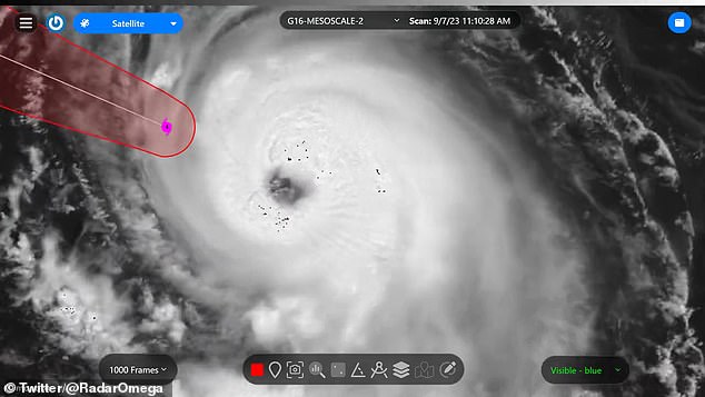

Hurricane Lee is pictured swirling over the Caribbean on Thursday – the first Category 5 storm of the season
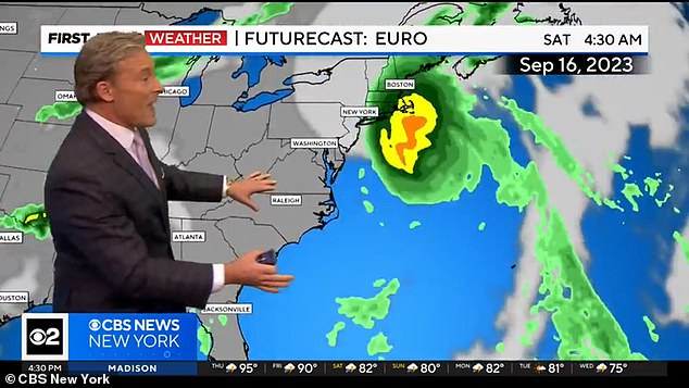

Some models suggested Lee could turn towards the New York area and slam into the Northeast late next week
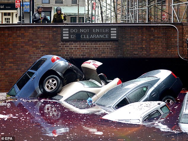

The threat of the storm has reminded some people of 2012’s Superstorm Sandy, which left parts of New York underwater and more than 230 dead in its path
Spaghetti models of Hurricane Lee’s path – maps which show computer simulations of where the center of the storm could be in several days time, given a set of variables – show Lee turning northeast and heading up the East Coast.
The closer the lines are together, the more confidence it gives forecasters in what the storm might do.
According to the European model, there is a front along the East Coast next week that could keep Lee at sea, but if it breaks apart, it would clear the path for the storm to hit the Northeast, CBS New York meteorologist said.
In that model, the storm would make landfall in Massachusetts.
An American model, meanwhile, shows Lee scraping along the coast of Cape Cod, and then heading into the Canadian Maritimes.
In that scenario, the East Coast would still feel the impact of the storm – though it would likely be less than a direct hit.
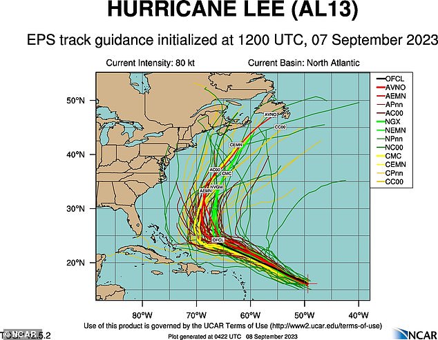

A spaghetti model shows the possible course of Hurricane Lee: the closer together the lines, the stronger the prediction
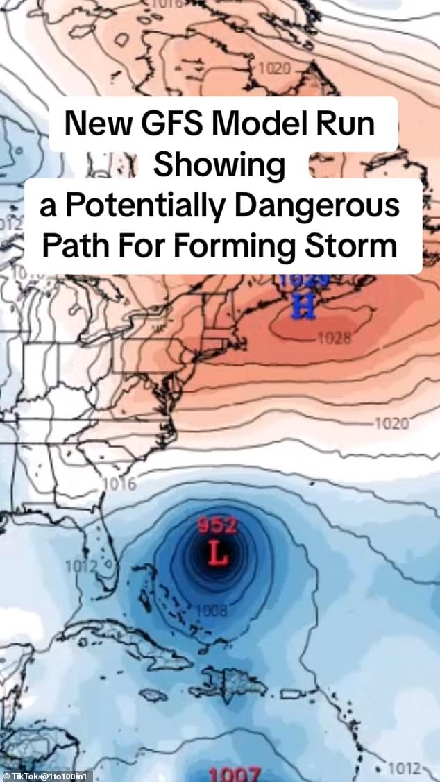

Lee is pictured circulating north of Turks and Caicos in one model. It is not expected to hit Florida
On Thursday night, Lee was located about 705 miles east of the northern Leeward Islands.
It was a Category 4 storm, which means it has sustained winds between 130 and 156ph. But forecasters expect it to reach Category 5 in the coming days.
Most models show it as a Category 4 as it approaches the U.S. coast.
President Joe Biden on Thursday was given the hurricane’s latest trajectory and details of preparations underway by the U.S. Federal Emergency Management Agency, which deployed unidentified assets to Puerto Rico and the U.S. Virgin Islands, according to the White House.
The storm is expected to cause life-threatening surf and rip currents to the Lesser Antilles on Friday. Swells are expected to hit the U.S. Virginia Island, Puerto Rico, the Bahamas and Bermuda this weekend.
‘We will see waves between 10 and 15 feet, so we don’t want anyone on the beaches,’ said Ernesto Morales with the National Weather Service in San Juan, Puerto Rico.
The National Hurricane Center said dangerous surf and rip currents were forecast for most of the U.S. East Coast starting on Sunday.
Lee is the 12th named storm of the Atlantic hurricane season, which runs from June 1 to November 30, and peaks in September.
Tropical Storm Margot became the 13th named storm after forming on Thursday evening. It was located some 290 miles west-northwest of the Cabo Verde Islands.
The US is still recovering from Hurricane Idalia, which made landfall in Florida in late-August. It brought rain and deadly surge to parts of the Sunshine State and also caused havoc in Georgia and the Carolinas.
Hurricane Idalia was responsible for four deaths.
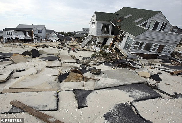

Ortley Beach, New Jersey, was devastated by Hurricane Sandy in 2012 that caused more than 230 deaths worldwide
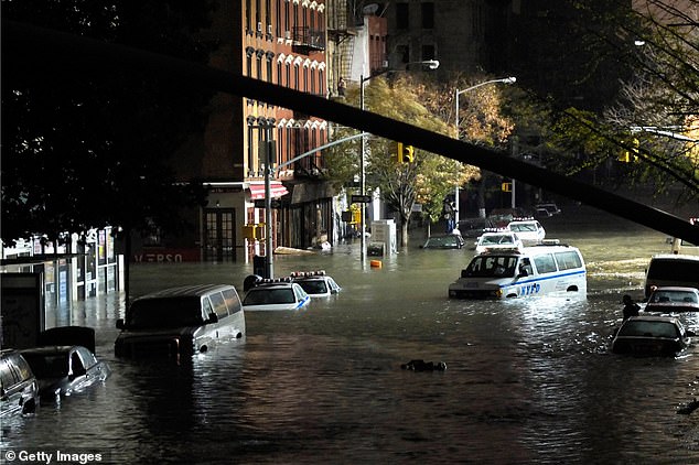

The East Village of Manhattan is pictured following Hurricane Sandy as streets were left underwater
The only major hurricane to hit New York City was in 1938, but the city remains traumatized by Superstorm Sandy, which swept through in October 2012 and caused an estimated $19 billion in damages.
Sandy was responsible for more than 230 deaths worldwide.
The storm in New York damaged many landmarks, including the Statue of Liberty, which was closed for more than eight months after the storm.
Sandy ushered in a catastrophic storm surge, with tides 12.65 feet above normal levels at Kings Point on the western end of Long Island Sound, and 9.40 feet above normal at the Battery on the southern tip of Manhattan.
Insurance and tax agent Craig Fischette, 70, said in 2022 that Sandy was ‘horrible and still is’ and that he was inundated with insurance requests at a time when he didn’t even have a place to work.
His files were destroyed and he had to reconstruct his clients’ accounts as best he could from the wreckage.
Fischette, who runs Nationwide Insurance in Rockaway, said: ‘Papa John’s next to my office exploded and burned the entire block down. We had 7ft of water come through here.
‘Almost all of my clients had flood claims but I didn’t have an office. I didn’t have their records as they were destroyed in the fire.
‘The odds were that we weren’t going to come back but people did’.

