Receive free Climate change updates
We’ll send you a myFT Daily Digest email rounding up the latest Climate change news every morning.
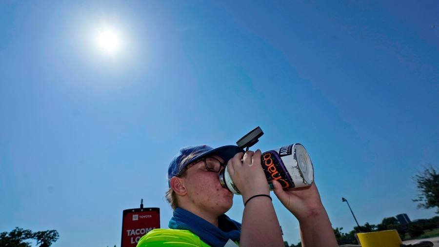
Nearly 110mn Americans are living in an area the US weather service has flagged as experiencing extreme heat, and at least 100 people are estimated to have died in Mexico where temperatures came close to 50C.
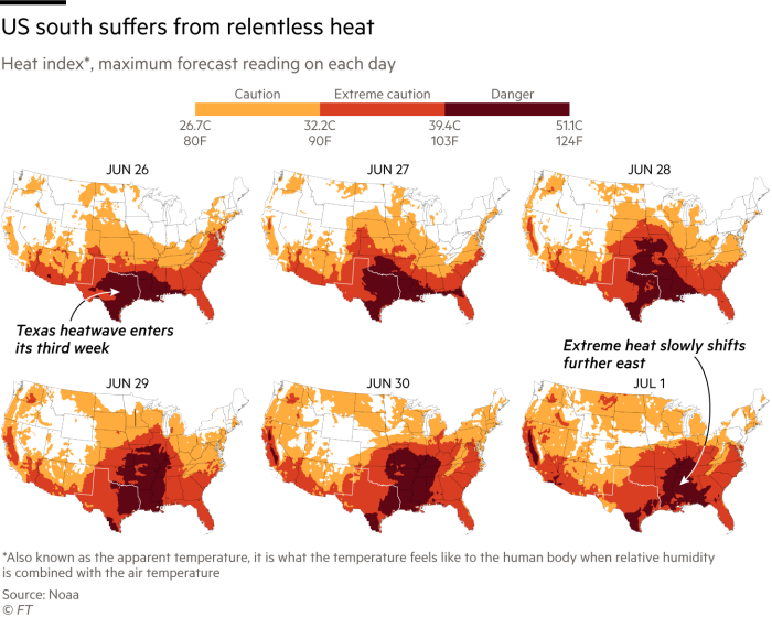
The “heat dome” causing the deadly conditions stretched far to the south and hovered over US states including Texas, Tennessee and Arkansas, leading to warnings that “hazardous heat” would remain into the weekend.
Temperatures were forecast to exceed 43C (110F) across the Gulf coast. In Texas, the heat pushed demand for power to a record high as homes and businesses turned up the air conditioning.
“It’s hotter and more humid than usual,” said David Roth, a forecaster with the National Weather Service. “Or else we wouldn’t issue these heat advisories. This is not an everyday phenomenon: this is unusual.”
Mexican health authorities attributed the deaths of more than 100 people to heat stroke or dehydration over the last fortnight of June as citizens endured a three-week heatwave that stretched the power grid’s capacity.
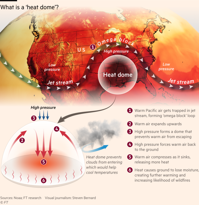
Scientists drew the cause of the high temperatures to the existence of the “heat dome”, a phenomenon that occurs when a high-pressure region traps heat.
The US government’s National Oceanic and Atmospheric Administration has observed that changes in the ocean temperature gradient running from west to east in the Pacific Ocean can provide the conditions for a heat dome.

The western Pacific’s temperatures have risen over the past decades compared with the eastern Pacific, according to NOAA, resulting in a pressure difference that causes warm air to rise and be blown east, before being drawn over the land by the northern shifts of the jet stream.
The jet stream, a band of fast-moving air high in the atmosphere, usually moves in a wavelike pattern. When the waves become larger, they can move more slowly and eventually become stationary, leading to hot or cold air becoming trapped.
Jennifer Francis, a senior scientist at the Woodwell Climate Research Center, said the ocean was warming because of climate change, in turn causing larger waves in the jet stream. “What we’ve been seeing for the last couple of months is an extreme level of waviness,” said Francis.
Additionally, the jet stream had weakened and developed larger, slower- moving waves as the temperature differential between the Arctic and the rest of the globe reduced, said Francis. The Arctic is warming four times faster than the rest of the globe, scientists have found.
“The temperature difference is getting smaller, and this means the east-to- west winds of the jet stream are getting weaker,” Francis said. “When those winds get weaker, we tend to see the jet stream take bigger north-to-south swings and create these bigger waves”.
Michael Mann, a professor of earth and environmental science at the University of Pennsylvania, said it was “difficult to parse out the precise roles of the various factors” behind the present heat dome.
But he added that climate change was bringing more persistent “stuck” summer jet stream patterns, leading to hot sinking air becoming trapped over one region.

In June, scientists pronounced the return of El Niño, a weather phenomenon associated with warming across the Pacific Ocean. Scientists at NOAA have questioned whether the effect would be immediately apparent, however.
“Sure, El Niño is having an impact right now on the large-scale atmospheric circulation, and could be playing a role in this current jet stream configuration,” said Mann. “But El Niño has happened many times before without giving us such unprecedented weather extremes.”
The heat in the US comes as the world’s oceans hit record high temperatures for two months running, according to the US National Oceanic and Atmospheric Administration. Above-normal sea-surface temperatures had “recently expanded across the central and eastern equatorial Pacific”, it said.
Climate Capital

Where climate change meets business, markets and politics. Explore the FT’s coverage here.
Are you curious about the FT’s environmental sustainability commitments? Find out more about our science-based targets here