A tornado alert is in effect for areas in south central Alberta, as Environment Canada meteorologists are tracking a severe thunderstorm that is possibly producing a tornado.
As of 4:40 p.m. the alert said Blackie, Brown-Lowery Park, Okotoks, Diamond Valley and High River are included in the warning.
“Damaging winds, large hail and locally intense rainfall are also possible,” read the alert.
“This is a dangerous and potentially life-threatening situation. Tornado warnings are issued when imminent or occurring thunderstorms are likely to produce or are producing tornadoes.”
A severe thunderstorm capable of producing very strong wind gusts, hail from the size of a nickel to a ping pong ball and heavy rain was also being tracked by Environment Canada in the Calgary area.
The weather agency stated that severe thunderstorm watches are issued “when imminent or occurring thunderstorms are likely to produce or are producing one or more of the following: large hail, damaging winds, torrential rainfall.”
“Large hail can damage property and cause injury. Strong wind gusts can toss loose objects, damage weak buildings, break branches off trees and overturn large vehicles. Remember, severe thunderstorms can produce tornadoes,” the weather agency wrote in its watch.
Environment Canada also issued a heat warning on Friday, warning that Calgarians should monitor themselves for symptoms of heat stroke or heat exhaustion.
For a full list of current weather warnings, click here.
Thursday’s storm
People in many areas of Calgary’s inner-city were cleaning up after a severe thunderstorm on Thursday brought intense rain and hail to the city.
On Thursday, there were power outages in several areas, affecting hundreds of people. West Hillhurst, Ogden, Foothills, Riverbend, Shepard Industrial, Dover, Southview, Rosscarrock, Parkdale, Montgomery, Valleyfield, Capitol Hill, and Wildwood were among the areas affected.
Tsuut’ina Nation and Rocky View County were also affected by outages.
As of 2 p.m. Friday, Enmax has listed the outages as having been resolved.

Amid the storm, Calgary police had asked the public to avoid some areas due to damage.
On Thursday evening, police asked Calgarians to avoid the area of 10th Street N.W. between 16th Avenue N.W. and 13th Avenue N.W. as emergency crews were on scene addressing road damage caused by heavy rainfall.
Police had also said Blackfoot Trail S.E. was closed at the Ogden Road S.E. bridge due to flooding caused by the heavy rain.

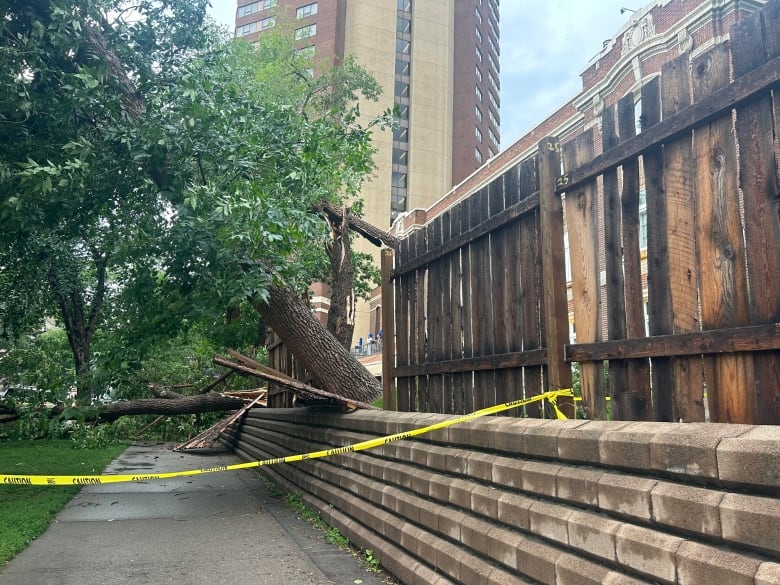
Damage could also be seen in the Beltline area as trees were strewn on the sidewalk.
Kyle Brittain, weather specialist and freelance video journalist, said there was a lot of hail accumulation and precipitation that came down “extremely fast” in the storm.
“Quite a bit of a mess out there after that downpour,” he said.
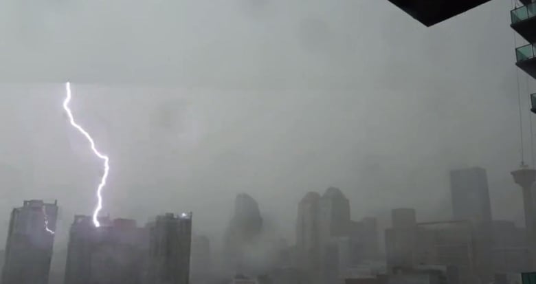
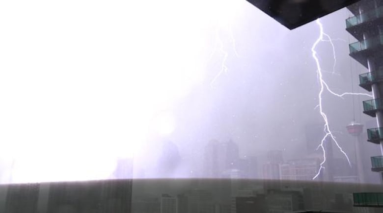
“We’ve had many good electrical storms over the years, but in my time of living in the Beltline area — about 10 years or so — I have never seen lightning like that and I’m usually out waiting for it if I’m not out storm chasing outside of the city.”

“I managed to capture many lightning strikes on camera, including one that hit a building just a few blocks away right out the front window.”
Environment Canada had said in an alert earlier Thursday that meteorologists were tracking a severe thunderstorm capable of producing very strong wind gusts, up to nickel size hail and heavy rain. As of 7:45 p.m. that alert had ended.
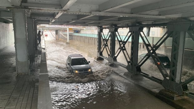
Earlier in the evening, storms had caused water to pool on the roads in the city.

On Twitter, Sgt. Chris Martin said if drivers find themselves at an underpass with water in it not to proceed unless they’re confident it is shallow enough for the vehicle to get through safely.
“Vehicles getting stuck in flooded underpasses is a common call during and after storms and it needlessly puts you at risk,” the tweet read.