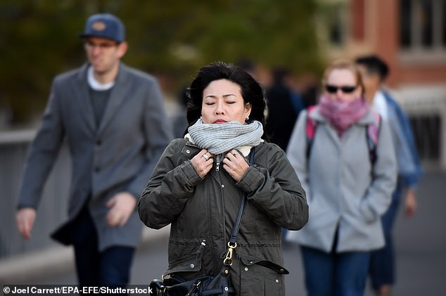
Abnormally low temperatures have left Australians shivering through endless cold nights as some cities experience one of the iciest Mays on record.
The last month of Autumn was particularly brisk for people living in Sydney and Brisbane, where minimum temperatures hit record lows.
Residents have experienced some of the coldest May nights in decades as forecasters warn icy winds and wintry temperatures are here to stay.
A series of large high-pressure systems hovering over Australia’s centre and southwest have created a stream of cold air over the east and southeast.
The conveyer belt of systems has also brought clear skies and a light breeze, creating the perfect storm for abnormally low overnight temperatures.

Abnormally low temperatures have left Australians shivering through endless cold nights after experiencing one of the iciest Mays on record (pictured, pedestrians brave the cold in Sydney)
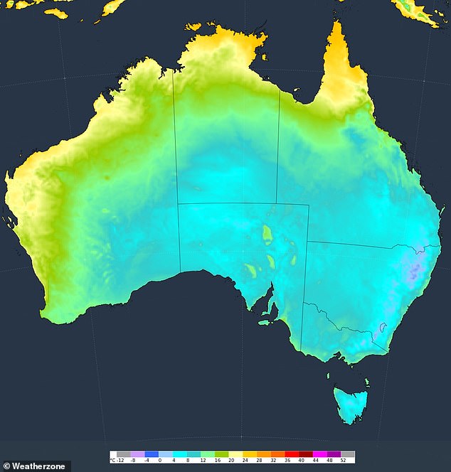


The last month of Autumn was particularly brisk for people living in Sydney and Brisbane where minimum temperatures hit record-lows (pictured, daily minimum temperatures)
In NSW and Queensland, the average temperature has consistently sat at -3.5C, with many locations experiencing their coldest May nights on record.
In the Queensland city of Ipswich, Amberley’s average monthly temperatures to 9am reached a measly 5.2C, well below the long-term average of 10C.
It also beat out the 2006 record of 6.1C.
In Sydney, the average minimum temperature at Observatory Hill up to 9am on May 30 was just 10C, 1.6C below average.
It was the Harbour City’s lowest May minimum temperature since 1957.
Temperatures in the western suburbs dropped even lower, with Richmond Airport recording an average monthly minimum of 4.4C – the lowest since 1957.
Records were also broken on Saturday, with Sydney’s Observatory Hill recording a minimum temperature of 6.9°C at 7:04am – its coldest May morning in 24 years, while Bega’s -1.6C was its coldest in 15 years.
NSW suburbs, including Camden and Tibooburra also recorded their coldest mornings for the month in 12 years, with minimum recorded temperatures of -1.2C and 3.8C respectively.
The temperature dropped to 1.1C by 5.30am in Perth, marking the coldest May morning the area has experienced in 59 years.
The chilly start was only 2.4C warmer than Perth Airport’s record minimum of -1.3C set on June 17, 2006.
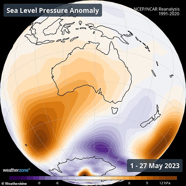


A series of large high pressure systems hovering over Australia’s centre and southwest have created a stream of cold air over the east and southeast
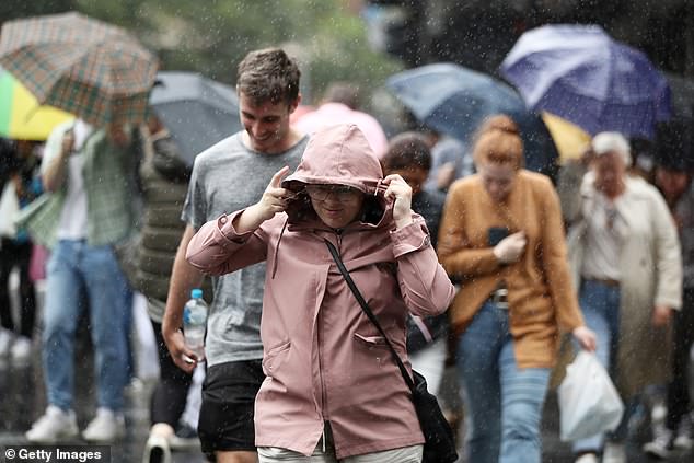


Residents have experienced some of the coldest May nights in decades as forecasters warn icy winds and wintry temperatures are here to stay (pictured, pedestrians in Sydney)
Weatherzone forecaster Felix Levefque said colder temperatures were to be expected as the country transitioned from El Niño from La Niña.
‘With the easing effects of La Niña we are seeing a dryer climate. Cloud cover allows overnight temperatures to drop quite significantly,’ he told Daily Mail Australia.
‘As we get into nightfall there’s no cloud cover to retain the heat.’
The forecaster warned there would be some ‘notable cold outbreaks’ this winter, which would be cooler than the last three years due to the easing of La Niña .
‘It’s been a noticeably cold May,’ he said.
‘Temperatures have dropped overnight leading to many spells of cold nights.’
A ‘vigorous’ westerly flow and a cold front on Wednesday is expected to bring rain to parts of southern Tasmania and southern Victoria on Thursday.
A series of high-pressure system across will see the unseasonably cold weather continue to end of the week and into the weekend.
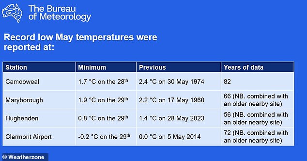


Record cold temperatures were reported at several Queensland locations, including Maryborough, Hughenden, Clermont Airport and Camooweal on Monday
Source: | This article originally belongs to Dailymail.co.uk