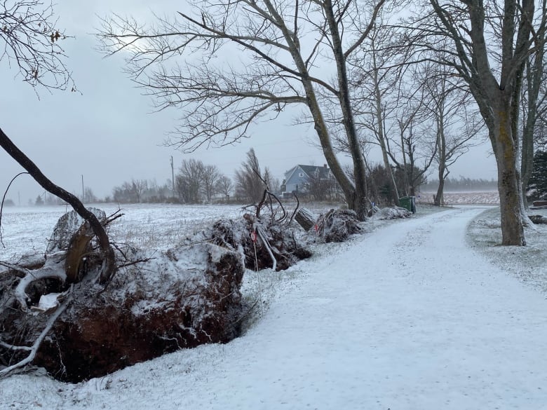
Much of the Maritimes was under winter storm warnings on Tuesday, with a snowstorm forcing the closure of schools in parts of Nova Scotia and P.E.I. and thousands of homes and businesses without power, mostly on Cape Breton Island.
Travellers are being warned of treacherous conditions in eastern Nova Scotia. The forecast called for up to 40 centimetres of snow, along with winds gusting at up to 100 km/h. By afternoon, the snow had changed to rain.
CBC News meteorologist Tina Simpkin says the storm began overnight on Cape Breton, with 15 centimetres already down by sunrise in some places.
“It is blowing snow, so this is not going to be fun,” she said.

Up to 40 millimetres of rain could fall on parts of the island, raising the possibility of flooding, according to Environment Canada.
A number of schools and some government offices are closed across Nova Scotia. Meanwhile, Transit Cape Breton is not operating due to poor road conditions, and ferries to and from Sydney, N.S., are cancelled for the day.
Nova Scotia Power’s outage map showed about 16,000 customers without power as of late Tuesday afternoon, including about 13,500 in Cape Breton.
Up to 30 cm of snow in P.E.I.
In P.E.I., the storm started in Kings County in the east but was forecast to spread to the whole province in the afternoon. Up to 30 centimetres of snow was expected.
“Snow continues to push west through the afternoon and evening, with a gusty 50 to 80 km/h northwest wind, gusts topping 90 km/h possible for exposed/coastal areas,” said CBC meteorologist Jay Scotland.
“Road conditions will deteriorate during this afternoon and evening, with blowing and drifting snow, and I can’t rule out potential local outages as well due to high wind.”

The storm is expected to continue through the night and taper off around dawn, with the possibility of ice pellets, freezing rain and rain.
Higher than normal tides could also come with the storm, Environment Canada said in its associated special weather statements.
Make sure your phone has a good charge folks! Snow (mixing with rain for some areas overnight), combined with a gusty wind is not a good combo for branches and power lines. Local outages are possible.
—@JayScotland
The Public Schools Branch has staggered school closures and cancelled all after-school, student-related activities, while the University of Prince Edward Island closed early. A more extensive list of closures can be found here.
Snow to mix with rain in N.B. overnight
Meanwhile, northern, eastern and some central areas of New Brunswick will see snowfalls of up to 25 centimetres in some regions from Tuesday afternoon and continuing Wednesday.
Environment Canada is warning of “hazardous winter conditions” with those areas also expecting winds up to 90 to 100 km/h. Snow is expected to become heavy by Tuesday evening and mix with rain overnight.
This is what we have to look forward to, SE/NE New Brunswick! <a href=”https://t.co/wHeNOvkZIQ”>https://t.co/wHeNOvkZIQ</a>
—@JonnaBrewerCBC
Residents in areas with winter storm warnings in place are being advised to postpone non-essential travel as “visibility may be suddenly reduced at times in heavy snow.”
Other regions of the province are under snowfall warnings, with 15 to 20 cm of snow expected, beginning Tuesday evening until Wednesday at noon.
Elsewhere in Atlantic Canada, many parts of Newfoundland are under rainfall and wind warnings, with heavy rain and strong winds expected.
Some northwestern regions of the province including Gros Morne could also see 15 to 40 centimetres — or higher — of snow, according to Environment Canada.