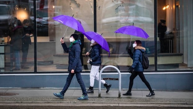
British Columbia’s South Coast is in for yet another round of heavy rain and strong winds as the next atmospheric river of the season approaches.
Heavy rain and strong winds are expected to hit Metro Vancouver, Fraser Valley, Howe Sound, the Sunshine Coast, east Vancouver Island, Victoria and the Southern Gulf Islands starting Thursday night, with the possibility 30 to 70 millimetres through Friday, according to a special weather statement from Environment and Climate Change Canada.
Winds could range from 40 to 60 km/h, while Victoria may see gusts of up to 80 km/h.
Models show 40 to 50 millimetres of rain is forecast through Saturday in Comox on Vancouver Island and in Sechelt on the Sunshine Coast, which are both still ranked at drought Level 5, the most severe rating on the province’s drought scale.
Atmospheric River impacting <a href=”https://twitter.com/hashtag/CampbellRiver?src=hash&ref_src=twsrc%5Etfw”>#CampbellRiver</a> <a href=”https://twitter.com/hashtag/ComoxValley?src=hash&ref_src=twsrc%5Etfw”>#ComoxValley</a> <a href=”https://twitter.com/hashtag/PortHardy?src=hash&ref_src=twsrc%5Etfw”>#PortHardy</a> next 2-3 days Heavy rain 30-70mm & Winds 40-80km/h expected <br><br>Crews patrolling Service Area Hwys until the event passes <br><br>Check <a href=”https://twitter.com/DriveBC?ref_src=twsrc%5Etfw”>@DriveBC</a> Drive with caution; to conditions <a href=”https://twitter.com/hashtag/bcstorm?src=hash&ref_src=twsrc%5Etfw”>#bcstorm</a> <a href=”https://twitter.com/hashtag/ShiftintoWinter?src=hash&ref_src=twsrc%5Etfw”>#ShiftintoWinter</a> <a href=”https://twitter.com/TranBCVanIsle?ref_src=twsrc%5Etfw”>@TranBCVanIsle</a> <a href=”https://t.co/4GFl4878Pl”>pic.twitter.com/4GFl4878Pl</a>
—@MainroadNIsland
Derek Lee, a meteorologist with Environment and Climate Change Canada, said this next stretch of weather will be similar to one last week that brought several days of heavy rain over B.C.’s central and south coasts.
“Atmospheric rivers are certainly not a new phenomenon, but they do transport lots of water vapour to the Pacific Northwest,” Lee said.
“They will vary in intensity, duration and impact. So in other words, not every atmospheric river event is comparable to the one of November 2021,” he added, referring to the downpours that led to widespread flooding across the south of the province last year.
Snowfall warnings
An atmospheric river, or AR, is a large, narrow stream of water vapour that travels through the sky.
As the rivers cross from the ocean to the land — particularly to mountainous regions like the B.C. coast — the vapour condenses into precipitation.
On Friday, snow levels could drop down to 300 metres before rising back up to usual levels, CBC meteorologist Johanna Wagstaffe said. That could bring some wet snow to higher areas of Metro Vancouver like the North Shore and Burnaby Mountain.
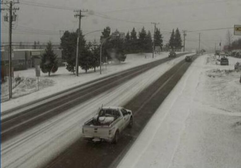
Environment Canada has also issued snowfall warnings for much of B.C.’s Interior and northern regions, with up to 30 centimetres of snow expected in some places.
Flurries are expected to hit around noon on Thursday, lasting until Friday morning. As temperatures warm on Friday, that snow will likely become rainfall.
Sheltering the vulnerable
In response to the incoming weather, the City of Vancouver is opening a handful of shelter spaces and a warming centre, which will remain open until Monday.
Please share: Additional shelter spaces and a warming centre are available tonight through Monday, November 7, due to an Extreme Weather Alert.<br><br>Details ⬇️ <a href=”https://t.co/FAE8KUnkZo”>pic.twitter.com/FAE8KUnkZo</a>
—@CityofVancouver
Nicole Mucci, spokesperson for the Union Gospel Mission in Vancouver’s Downtown Eastside, is concerned about the impact the weather is having on the city’s most vulnerable.
Speaking Thursday on CBC’s The Early Edition, Mucci said the mission shelter, which has space for 92 people, has been “uncharacteristically full” over the past 10 months and she worries there will not be enough space for those in need.
“They are exposed to these elements 24 hours a day, seven days a week, and it can wreak havoc on their immune systems… it also can put people in danger when they’re trying to find ways to keep warm themselves if they aren’t able to stay in a shelter,” said Mucci.