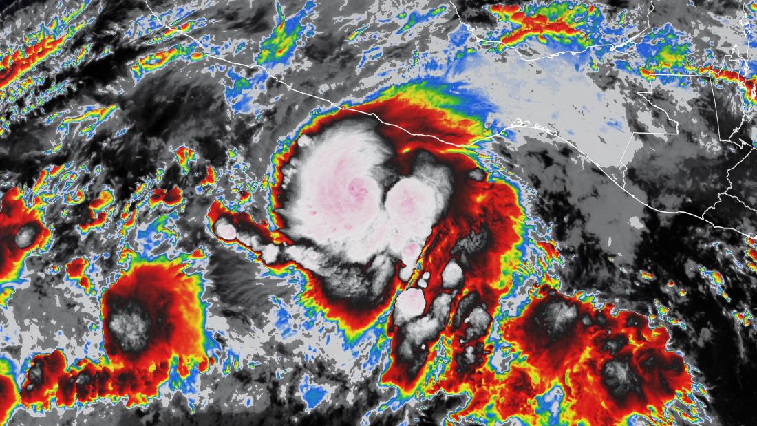
Agatha is now just shy of a Category 3 storm and is expected to continue gaining strength before making landfall Monday evening near Salina Cruz, Mexico.
The storm is located about 125 miles southwest of Puerto Angel, Mexico, according to the Sunday night update.
A hurricane warning is in effect for Salina Cruz to Lagunas de Chacahua. Tropical storm warnings are in effect for Salina Cruz eastward to Boca de Pijijiapan and Lagunas de Chacahua westward to Punta Maldonado.
Tropical storm conditions were expected to arrive across southern Mexico Sunday night with hurricane conditions arriving in the warning area Monday.
“Storm surge could produce coastal flooding near and to the east of where the center passes the coast in areas of onshore winds,” the National Hurricane Center said. “The surge may be accompanied by large and destructive waves.”
In addition to storm surge, heavy rains from Agatha will hit portions of southern Mexico by Sunday into Tuesday night.
“The heaviest rain is forecast across the Mexican state of Oaxaca, where 10 to 16 inches are expected but isolated totals up to 20 inches is possible,” the hurricane center said.
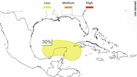
After crossing land, the remnant low of a dissipated Agatha could reemerge into the southern Gulf of Mexico by the middle of this week.
The National Hurricane Center has highlighted a 30% chance of development over the next five days across the region.
