A tsunami triggered by a landslide in a remote, uninhabited part of Greenland shook the entire Earth for nine days, according to new research.
In September 2023, seismologists around the world were puzzled by a strange signal that showed up on their instruments. It wasn’t the usual jagged, spiky sign of an earthquake, but rather a smooth wave that went back and forth every 90 seconds, similar to a single low note, which continued for nine days.
The scientists at the time labelled the odd signal an unidentified seismic object, or USO.
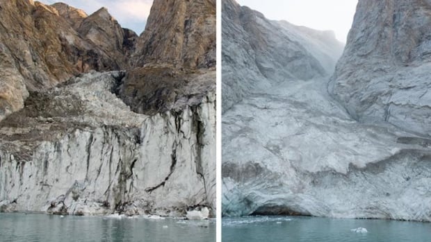
Now, according to a new study published in the journal Science, we finally know what happened. It took an international team of scientists using satellite data, seismometers and ground searches to trace the source of the signal to the Dickson Fjord on the east coast of Greenland. Photos taken before and after the event showed a huge landslide had taken place — the tip of a mountain collapsed and crumbled down from a height of 1.2 kilometers.
This caused a landslide that flowed down over a glacier, hurtling 25 million cubic metres of rock and ice into the deep waters, creating a wave 110 metres tall — about the height of a 30-story building.
WATCH | Animation showing seismic waves propagating around the globe:
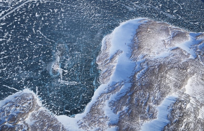
That section of the fjord has steep parallel sides only 10 kilometres apart, which allowed the waves to bounce back and forth off the opposite shores, like water sloshing in a bathtub or a cruise ship swimming pool in rough seas.
Using mathematical modelling, the researchers were able to simulate the tsunami and see how the water in the deep fjord was able to oscillate for such a long period. In addition, the long valley has bends at both ends of the straight section, so the energy in the water had nowhere to escape.
Thus the sloshing continued for nine days, shaking the Earth with it.
In their study, the researchers suggest that the landslide may have been caused by a glacier in the fjord below becoming thinner due to climate change and unable to hold back the steep sides of the valley.
This is the first recorded event where a condition in the atmosphere affected ice, which moved a mountain, caused water to move, and shook the entire globe of the Earth.
WATCH | Seismologist explains how mysterious ringing was traced to Greenland rockslide:
The scientists are also suggesting closer monitoring of these steep landscapes to ensure they are safe for public passage.
The Greenland ice sheet is the second largest on the planet after Antarctica, and it is losing ice at an accelerating rate. In a NASA study from January, 179 out of 207 glaciers in Greenland retreated significantly between 1985 and 2020.
Cruise often ships travel up Greenland fjords, including Dickson, so tourists can see those very glaciers. Fortunately, no ship was in the area when this landslide occurred, but it shows that the potential for danger is there.
And as climate change continues to warm the atmosphere, glaciers will continue to retreat up the fjords, possibly resulting in more of these landslide and tsunami events.