
If you take frequent road trips or travel on national highways across the country, then paying a toll fee is something you must be accustomed with. The toll fee is different on different routes. Even though digital payment methods are accepted at toll plazas, you might need to pay cash at times. In such cases, knowing in advance how much toll you have to pay can come in handy. Google Maps recently rolled out a new feature that does exactly that.
In a post on its community page, Google said that “to help make the choice between toll roads and regular roads easier, we’re rolling out toll prices on Google Maps for the first time.”
Launch the Google Map app on your mobile
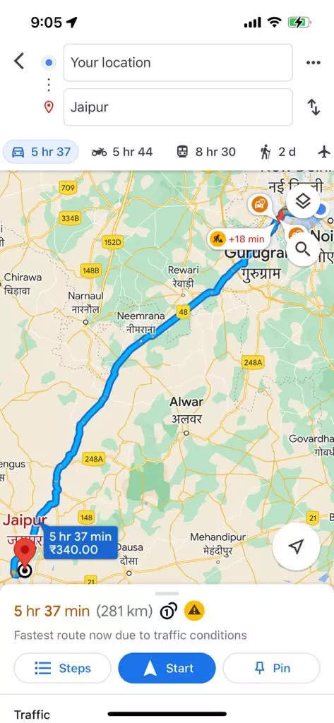
Enter your current location and destination
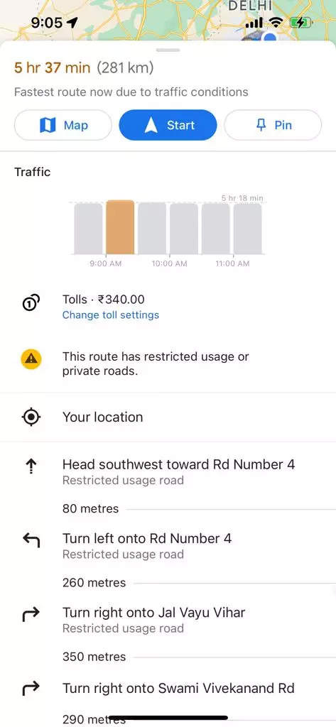
You will see the estimated toll price to your destination
Tap on Start to begin your journey
Further, users will have the option within settings to show toll prices with or without having a toll pass. This is because in certain areas in many geographies the price changes based on the payment method people use. If you don’t want to pay the toll and want to take another route, there is also the option to avoid crossing toll roads entirely, if possible, by selecting ‘Avoid tolls’ within settings.
FacebookTwitterLinkedin