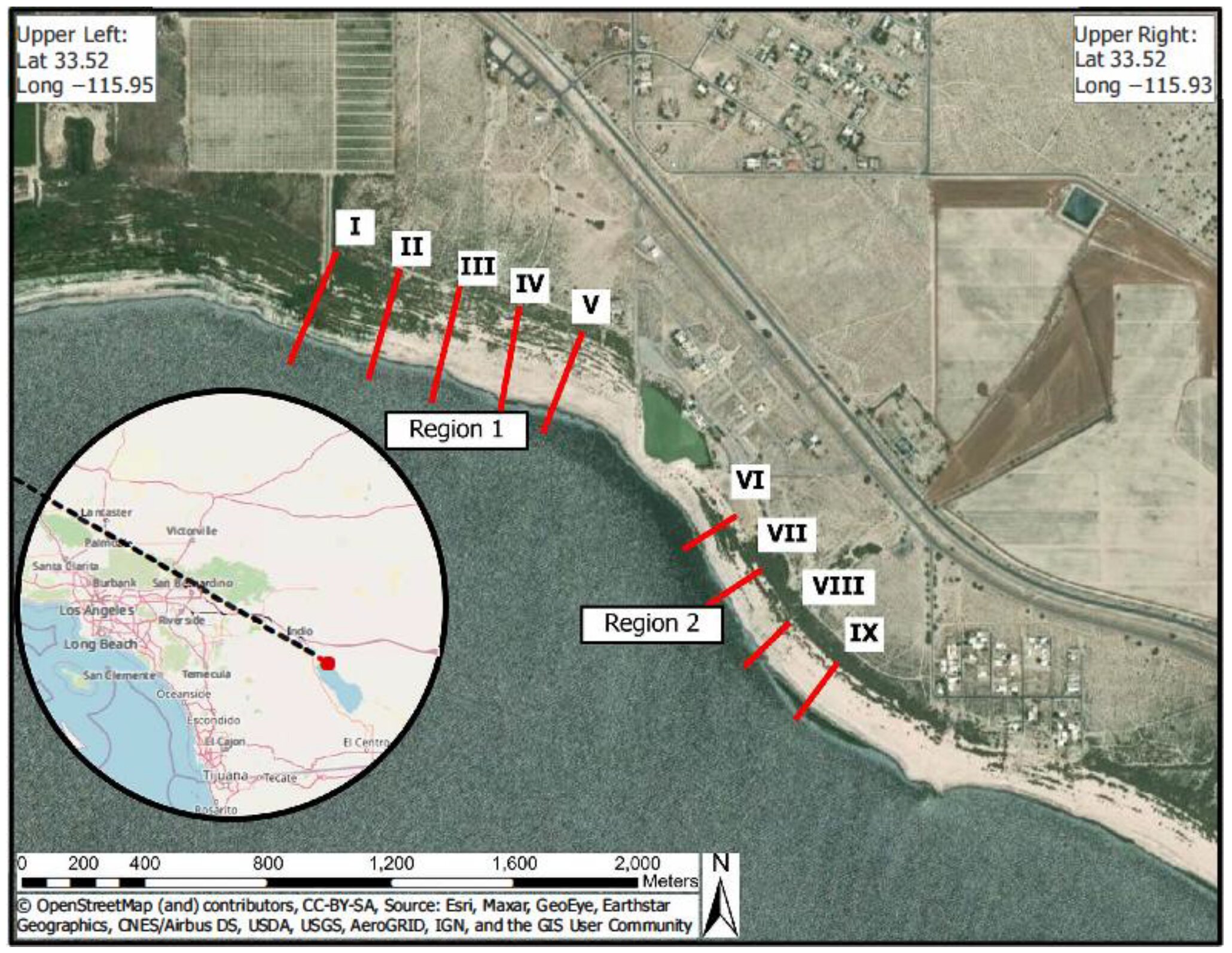

The Salton Sea, California’s largest lake by surface area, is experiencing an increasing rate of shoreline retreat following a policy change that shifted more water from the Colorado River to San Diego, according to a newly published study. The resulting dried lakebed is creating more polluted dust from dried agricultural runoff that affects nearby communities, researchers said.
Researchers forecast that parts of the Salton Sea’s North Shore are expected to retreat 150 meters by 2030 and an additional 172 meters by 2041 given the current rate of retreat.
The average rate of retreat between 2002 and 2017 rose from 12.5 meters a year to nearly 38.5 meters per year after 2018. “[W]ithout mitigation, the expanding exposed playa around the Salton Sea is expected to worsen pollutant exposure in local communities,” the study stated.
The study was conducted as a community science program involving local youth and other residents using balloon mapping to record images of coastline.
“This research was a direct response to a request from the community, which wanted to be involved in impactful research questions to understand shoreline reduction,” said Ryan Sinclair, Ph.D., MPH, associate professor of environmental microbiology at Loma Linda University School of Public Health and primary investigator of the study. “The community wants to be able to live next to a Salton Sea that they’re proud of.”
Sinclair said balloon mapping can cover a larger area compared to using drones, which need to be recharged.
The study was published last week in Geographries. The study authors included students, LLU faculty, staff from the Alianza Coachella Valley, and a researcher from University of California, Riverside.
The Salton Sea, located in the eastern Coachella Valley in Riverside and Imperial counties has increased and regressed in size for centuries. The lake’s volume level is now largely dependent on agricultural return flows from the nearby Imperial Valley, a vast farming region that holds key water rights from Colorado River diversion. The valley is granted more water than Nevada and Arizona combined.
In recent decades, water flow from the Colorado River to the region has been reduced following a change in water rights agreements in 2003, and more so since 2018 as more water has been sent to San Diego, Sinclair said. Salton Sea advocates contend with many longstanding water shareholders across Southern California, Nevada, Arizona, and Mexico. Shareholders include cities, residential zones, farms, tribes, and recreational areas.
Agricultural runoff to the Salton Sea brings pollutants, including hydrogen sulfide, which becomes enmeshed in dried lakebed and associated dust.
Sinclair and community members spent numerous days from 2019 to 2021 creating a series of maps using balloons outfitted with cameras suspended 200 feet above the shore. Researchers compared their findings with satellite images from 2002. They now hope their results can be part of efforts to restore the lake’s capacity.
“We started this at a strategic time,” Sinclair said of the study, which began shortly after policy makers diverted higher rates of water to San Diego starting in 2018.
More information:
Ryan G. Sinclair et al, A Balloon Mapping Approach to Forecast Increases in PM10 from the Shrinking Shoreline of the Salton Sea, Geographies (2024). DOI: 10.3390/geographies4040034
Provided by
Loma Linda University Adventist Health Sciences Center
Citation:
California’s Salton Sea receding at greater rate according to balloon mapping study (2024, November 1)
retrieved 1 November 2024
from https://phys.org/news/2024-11-california-salton-sea-receding-greater.html
This document is subject to copyright. Apart from any fair dealing for the purpose of private study or research, no
part may be reproduced without the written permission. The content is provided for information purposes only.