

The heavy rains, high winds, and storm surge that devastated land also left a mark on the ocean.
Hurricane Helene’s arrival in Florida introduced massive environmental shifts as seen in satellite images. The storm’s severe weather conditions stirred up coastal sediments, dramatically changing ocean color. These changes were documented by satellite imagery that showed how the landscape and seafloor composition were altered long after Helene passed.
Hurricane Helene’s Impact on Florida
On September 26, 2024, Hurricane Helene charged into Florida’s Big Bend area and pushed north with devastating consequences across several states. The heavy rains, high winds, and storm surge that affected land areas also left a mark on the ocean.
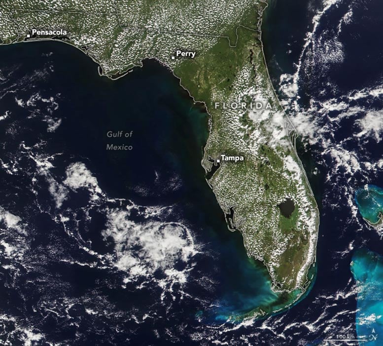
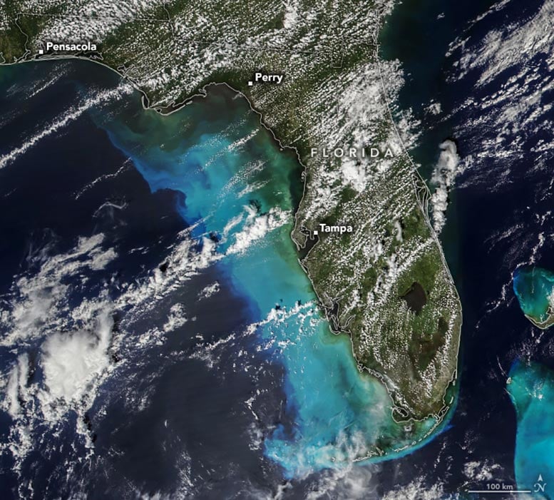
This image above (lower) shows the Gulf of Mexico on September 29, several days after Helene made landfall. For comparison, the upper image shows the same area on September 22 during more typical conditions. Both images were acquired by the VIIRS (Visible Infrared Imaging Radiometer Suite) on the NOAA-21 satellite.
Effects on Coastal Waters
Helene’s winds and waves churned up sediment from the seafloor along shallow coastal areas. Light reflects from these fine particles and makes the water appear bright blue. Storm surge, flooded rivers, and flash floods produced runoff that eroded land surfaces and carried even more particles into the ocean, adding to the color. NOAA had called for the storm surge to reach as high as 20 feet above ground level along parts of Florida’s Gulf Coast.
Pre-Storm Coastal Conditions
Notice that prior to the storm, coastal waters already displayed faint light-blue and dark-green colors. Some of this color is likely from suspended sediment, but much of it is due to the reflection of light off sea grass beds, the sandy seafloor, and coral reefs (especially around the Bahamas). Some of the darkest areas near rivers might be colored by dissolved organic material. The region’s blackwater rivers, for example, are rich with decaying vegetation and other organic matter, and their stained water can become flushed into the ocean during heavy rains.

Post-Storm Sediment Dispersion
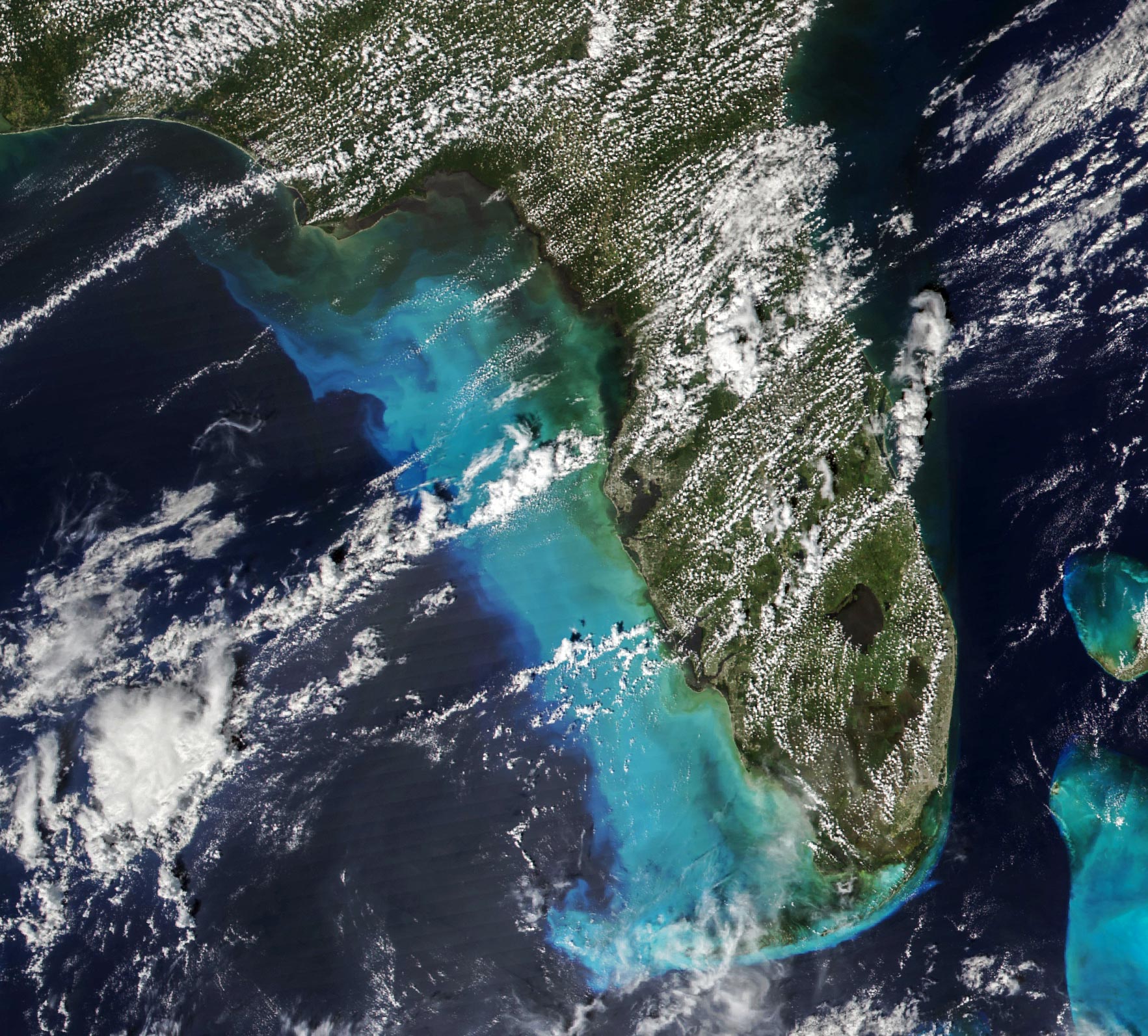
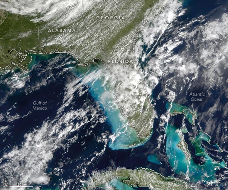
Suspended sediment colored the water across an even larger area on September 28. Clouds were abundant that day, but parts of the ocean surface were still visible when the OCI (Ocean Color Instrument) on NASA’s PACE (Plankton, Aerosol, Cloud, ocean Ecosystem) satellite captured this image.
The effect can be visible long after the passing of a storm. One week after Helene made landfall over Florida, swirls of sediment were still widespread on October 3.
NASA Earth Observatory images by Michala Garrison, using MODIS data from NASA EOSDIS LANCE and GIBS/Worldview.