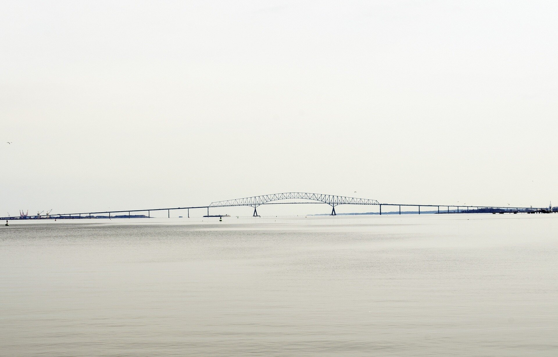

When Alice Volpitta watched the video of the Francis Scott Key Bridge collapse, and the trucks tumbling into the Patapsco River in the darkness, she thought first for the people who had fallen.
And as her mind raced, the Baltimore Harbor Waterkeeper thought of the river.
“What’s on that ship?” thought Volpitta, of environmental nonprofit Blue Water Baltimore.
As it turned out, the massive container ship that struck the bridge carried more than 1 million gallons of fuel and 4,679 shipping containers, 56 of them filled with hazardous materials.
But, for the most part, two weeks after the collapse, environmental advocates are breathing a sigh of relief.
Cleanup officials have maintained the wreck doesn’t pose an environmental threat, and have kept existing fish consumption restrictions the same for that section of the Patapsco. They’ve been testing air and water at the collapse site periodically since the wreck. The first rounds of water testing from the crash site, obtained by the Baltimore Sun, show no evidence of fuel or hazardous materials leaching into the river from aboard the ship.
“It could have been a lot worse,” said Bill Dennison, a marine science professor and interim president of the University of Maryland Center for Environmental Science.
In the initial days after the collapse, officials did report a visible sheen on top of the water near the ship, and crews deployed thousands of feet of protective booms. At the time, authorities attributed the sheen to a possible fuel discharge following the collision.
Dennison, who has spent time at the Unified Command center coordinating the collapse response as an adviser, said he heard the sheen could have been a small amount of “hydraulic fluid from the ship’s bow thruster.”
“It’s a very contained, small leak, considering the magnitude of what was carried on the ship,” Dennison said. “They were ready to go to Sri Lanka. They had a full load of fuel.”
Officials from the Unified Command center overseeing the cleanup and rescue operation declined to specify the nature of the fluid, but said “the safety of first responders and protection of the environment is a priority” for the Coast Guard and the command center.
Crisis was averted by a combination of luck and design, said Stefano Brizzolara, a professor specializing in ship design in Virginia Tech’s aerospace and ocean engineering department.
Modern ships like the Dali, a Singapore-flagged vessel built in 2015, typically locate fuel tanks close to the engine room, which is situated toward the stern. Regulations dictate how far from the sides and bottom of the ship they can be placed, he said.
And since the ship’s bow struck the bridge, fuel wasn’t likely to escape, though pipes in that area carrying lubricating fluid may have been damaged, causing the sheen. And the strike also left the ship miraculously upright.
“It was a lucky accident for the ship. It could have been worse if it was maybe at mid-ship … on just one side,” Brizzolara said. “If large, watertight compartments were flooded with water, the ship could have healed on a side.”
While small leaks often dissipate quickly, Dennison envisioned the nightmare scenario—a massive fuel spill—when he heard about the wreck.
“It would have covered the entire Inner Harbor, Middle Branch, the marshes, the pilings, the floating wetlands that the National Aquarium is installing,” Dennison said. “Also, the tide would have gone out into the bay, and who knows how far. But presumably, it could have been devastating to the Chesapeake Bay.”
Of the 56 hazmat containers aboard the Dali, 14 were breached during the crash, according to Unified Command. All 56 were accounted for.
“The hazardous materials onboard that spilled from 14 damaged or destroyed containers were lithium metal batteries, soap products, perfume products, or not otherwise specified resin. There is no threat to wildlife,” read a statement from the command center.
“When you hear soap and perfume as potential contaminants, you worry about the soap. Soap can be not very healthy for the environment. So we definitely would be watchful if any of that soap or perfume came out of those hazmat containers,” Dennison said.
But now, amid good sampling results, environmental advisers and advocates have largely turned their attention to the next possible ecological challenge, Dennison said.
“At this point, the attention has turned mostly to the sediments,” he said.
Ungrounding the ship’s bow, which is lodged in the mud, and lifting the fallen bridge from the river bottom is certain to kick up plenty of sediment, Dennison said. And as officials clear the channels for ships, it’s possible they will need to dredge.
And buried within that sediment are legacy contaminants from Baltimore’s industrial past.
To the west of the bridge site sits Wagner’s Point, Curtis Bay and Hawkins Point, which host numerous industrial sites, from coal piers to incinerators and chemical plants. To the east lies the Port of Baltimore’s Seagirt Marine Terminal. And just southeast is Sparrows Point, land heavily polluted by more than a century of steelmaking.
One site on Bear Creek, near the bridge site, had sediments so polluted with heavy metals that the EPA designated it a Superfund site, adding it to a list of the most polluted locations in the nation. Earlier this year, EPA unveiled careful dredging plans for the area, involving sediment screens, booms and treatment technology.
“In a typical dredge operation, there are mitigation efforts they can deploy,” Volpitta said. “They can use things like dredge curtains to reduce the amount of sediment that’s kicked up … The problem is, those types of measures may not be suitable to use, like specifically around the salvage efforts, because those curtains can get wrapped up in the debris, things like that.”
After initial rounds of river sampling screened for fuel and hazardous materials aboard the ship, such as battery acid, the Maryland Department of the Environment has expanded its testing to include metals, “to assess whether any of the activities might be causing contaminants in the river bed to be resuspended,” said spokesman Jay Apperson in a statement.
“Based on the results, which include a showing that levels are slightly higher upriver of the bridge, there is no indication that the activities are affecting those levels,” Apperson said.
Typically, dredging occurs only during the winter, to avoid interfering with underwater plants and wildlife as temperatures warm. But given the timing of the collapse, dredging could be needed during warm weather, Dennison said.
Migratory, spawning fish making their way up the Patapsco could be impacted by sediment clouds, as could underwater grasses, a critical habitat for bay life. If the water is too cloudy, the grasses will not get enough light to grow and reach the surface.
When it comes to crabs and oysters, the Chesapeake’s “cash crops,” the greater worry is for oysters, which are locked in place, Dennison said. If the water is too cloudy, sediment could smother the filter-feeding mollusks. And amid a rainy spring, extra runoff likely already has clouded the waters, he said.
The good news is that most of the bay’s life isn’t in the deep channel, where the Dali is sitting. Such channels aren’t known for abundant wildlife.
“The life that lives down at the bottom of that channel is just worms,” he said. “Most of the life on the Chesapeake Bay is on the edges—in the shallows.”
There’s also the question of where material dredged from the collapse site would go. There are two existing dredge material containment facilities nearby the Key Bridge.
Volpitta said she would like to see dredged materials tested before they are brought to storage sites.
“I understand that the dredging might need to happen quickly, but instead of just turning around and putting that material somewhere else, we need to temporarily store it and house it so that it can be properly tested before it then gets disposed,” Volpitta said.
For some residents of communities downstream of the Key Bridge in Anne Arundel County, including Stoney Beach and Riviera Beach, the collapse was followed by an “initial period of a lot of fear,” said John Garofolo, a Stoney Beach resident and watershed steward.
The neighborhood was overrun at times by journalists and gawkers, eager to see the devastation, he said.
Soon after the crash, debris started to wash ashore, said Garofolo, who walks the neighborhood nearly every day. The community often sees debris on its beach, especially after storms or after the Conowingo Dam opens its gates, he said. But this debris was unique. Wooden pieces from the bridge, life vests and fire extinguishers.
Residents wondered, he said, if those things were flowing into Stoney Beach, what else was? Could the fuel and hazardous materials aboard the ship reach the community, too?
As the days passed, and environmental officials shared the good results, that fear ebbed a bit, but Garofolo said he’s still planning to treat the water with caution as springtime turns into summer.
Stiil, Grafolo said, “I wouldn’t swim in the water or fish or crab here myself, personally, for the next six months at least.”
2024 The Baltimore Sun.
Distributed by Tribune Content Agency, LLC.
Citation:
Environmental groups grateful but vigilant after Key Bridge collapse (2024, April 12)
retrieved 12 April 2024
from https://phys.org/news/2024-04-environmental-groups-vigilant-key-bridge.html
This document is subject to copyright. Apart from any fair dealing for the purpose of private study or research, no
part may be reproduced without the written permission. The content is provided for information purposes only.