By

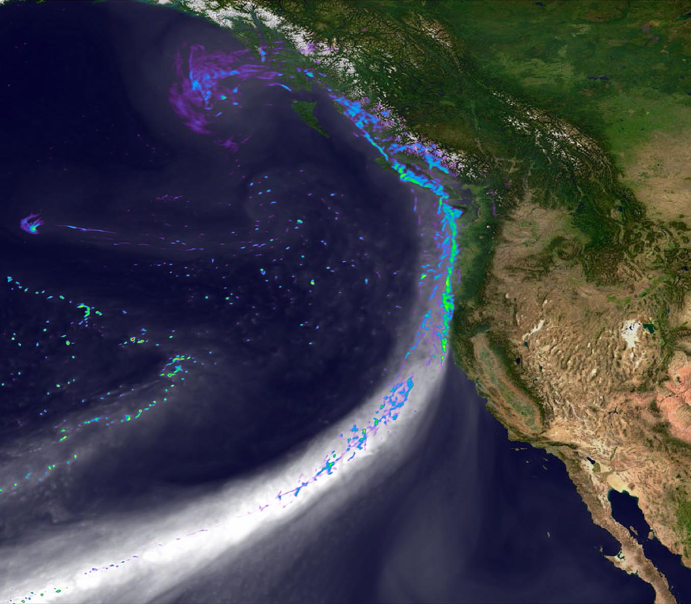
Snapshot of the simulated landfall of an atmospheric river along the west coast of North America on February 11, 2020. Grey tones depict water vapor. Colors indicate precipitation intensity from blue (light rain) to green (very strong precipitation). Credit: Department of Energy Office of Science, Energy Exascale Earth System Model (E3SM) project.
Atmospheric rivers are large, narrow sections of the Earth’s atmosphere that transport moisture from the Earth’s tropics near the equator to the poles. On average, at any given time the Earth has four to five active atmospheric rivers. They transport enormous amounts of moisture. Each moves the equivalent of the liquid water that flows through the mouth of the Amazon River. When atmospheric rivers reach land, they release this moisture, producing heavy snow and rain.
Atmospheric rivers are a very important part of the Earth’s climate. They are responsible for 90% of the movement of moisture from the tropics toward the poles. This means atmospheric rivers are a major factor in the formation of clouds and therefore have a significant influence on air temperatures, sea ice, and other components of the climate.
Moisture from atmospheric rivers shapes large parts of the world. Research indicates that they are responsible for more than half of the rainfall in parts of the coasts of North America, France, Spain, Portugal, the United Kingdom, South America, Southeast Asia, and New Zealand. As such, they are critical to plant and animal life, agriculture, and people as sources of water. But atmospheric rivers can also cause severe flooding due to the massive amounts of precipitation they release.
Fast Facts
- DOE-sponsored research found that from 1979 to 2019, 24 atmospheric rivers hit the U.S. West Coast on average each winter.
- The storms that atmospheric rivers create are the source of about 50 percent of the U.S. West Coast’s water supply. They ended as many as three-quarters of the droughts in the Pacific Northwest from 1950 to 2010.
- In February 2022, the city of Brisbane, Australia received almost 80 percent of its normal annual rainfall in just six days from an atmospheric river. The flooding inundated more than 15,000 homes in the city and caused the death of nine people in northeastern Australia.
DOE Contributions to Atmospheric River Research
Understanding atmospheric rivers is essential to developing accurate models of the Earth’s climate. The Department of Energy (DOE) Office of Science supports research on atmospheric rivers through its Biological and Environmental Research program. The Atmospheric Radiation Measurement (ARM) facility, a DOE Office of Science user facility that provides the scientific community with observations of the Earth’s atmosphere, conducted detailed aircraft and shipborne measurements of atmospheric rivers during a large interagency field effort. To translate this research into climate and earth system models such as the cutting-edge Energy Exascale Earth System Model (E3SM), the Office of Science supports research on incorporating atmospheric rivers into computer simulations. To address fundamental understanding of variability and change of atmospheric rivers, a DOE-led international team of researchers created the Atmospheric River Tracking Method Intercomparison Project (ARTMIP). The group has helped the scientific community to make stronger predictions of how atmospheric rivers and their effects will change in a warming climate. With DOE funding, ARTMIP has helped to produce 14 scientific papers and convene several meetings.