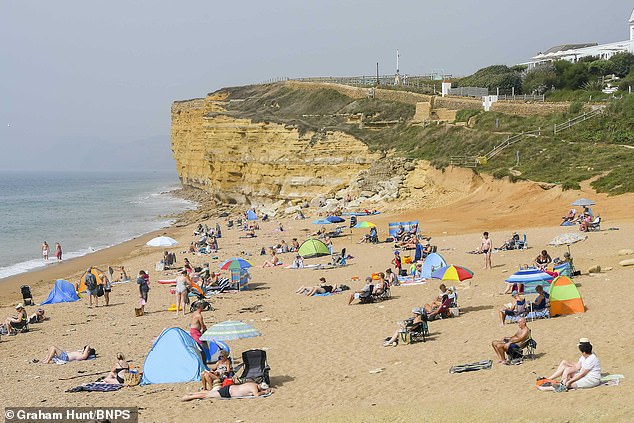
Brits flocked to the beach today to escape the sweltering heat of cities as the temperature soared to a scorching 32C amid the longest September heatwave on record.
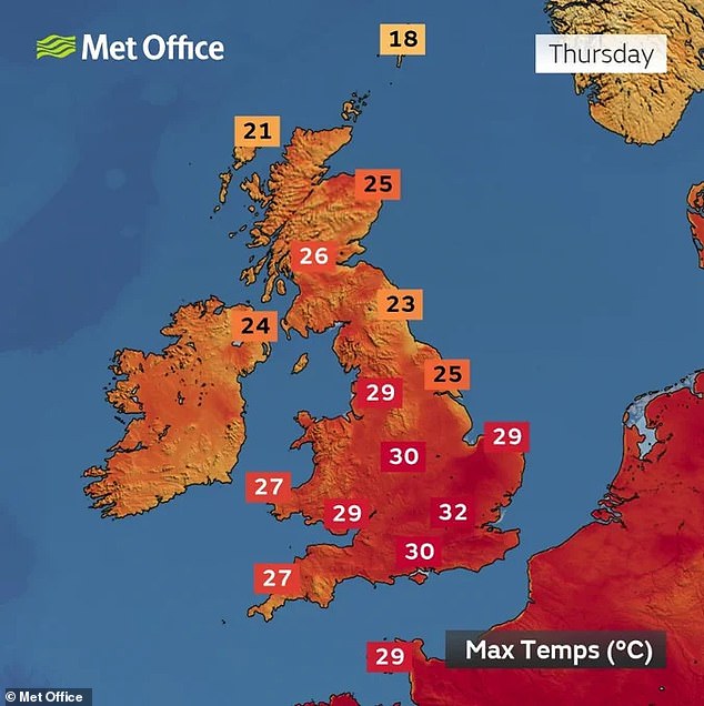
London is set tp hit 32C by 4pm this afternoon, with the highest temperature so far being recorded in the capital’s west as the mercury hit 30.2C in Northolt today.
Sun-seekers headed to beaches in Brighton, Bournemouth and Southend to make the most of the warm weather.
Swimmers were pictured taking a dip in the cooling waters of the sea while sun-worshippers were seen catching golden tans while reclined on loungers.
Temperatures up to 33C (91F) set to continue with an increasing chance of a thundery breakdown for some later in the weekend.
Brits flocked to the beach today to escape the sweltering heat of cities as the temperature soared to a scorching 32C


Friends and family took to the beaches to make the most of the glorious weather


Swimmers at Brighton beach were pictured taking a dip in the cooling waters of the sea
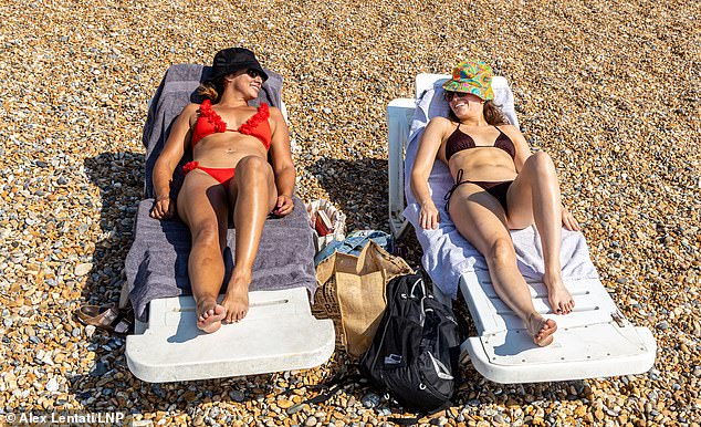


Sun-worshippers were seen catching golden tans while reclined on loungers in Brighton


Brits headed to beaches today to escape the sizzling heat of the cities to enjoy the warm weather


Beaches were packed full of Brits taking opportunity of the heatwave for some fun by the coast
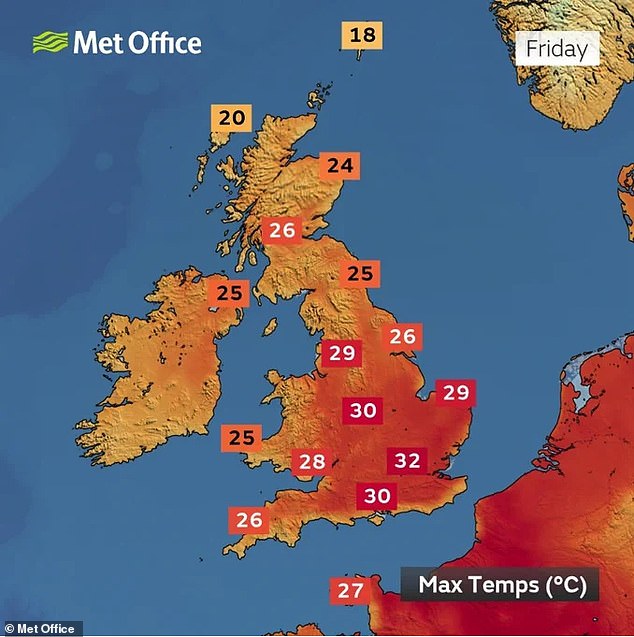
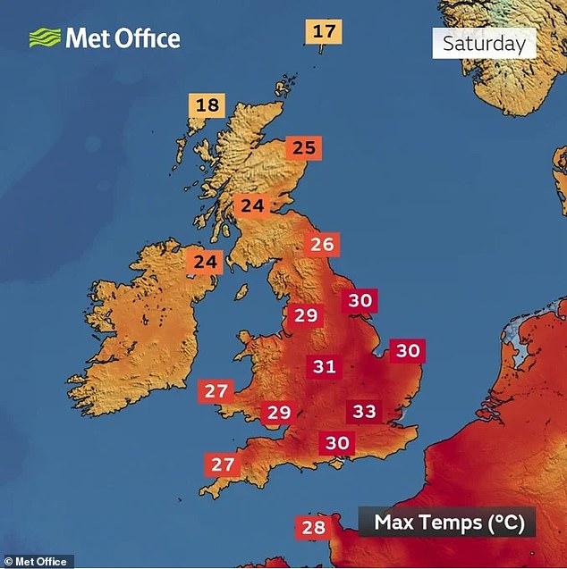
The Met Office is predicting seven days in a row above 30C (86F) for some areas between Monday and Sunday this week – and a likely peak on Saturday in London.
This week could see the highest temperature of the year so far, breaking the record for the most consecutive September days with heat of 30C (86F) or above.
A run of least 30C (90F) heat on three consecutive September days has happened just four times on record. This will be beaten today as the latest run gets to four days.
The September with the most 30C days over the month – not consecutive – was 1911, with five days. This will also likely be broken on Saturday when it will be six days.
And London Mayor Sadiq Khan today activated an emergency severe weather response for the capital which aims to help homeless people stay safe in the heat.
It comes after temperatures soared yesterday to 32C (90F) at Kew Gardens in West London, making it the warmest September day in the UK since 2016 and just short of the hottest day of 2023 which was 32.2C (90.0F), recorded both on June 10 and 25.
The run of 30C-plus heat began on Monday with 30.2C (86.4F) in Pembrokeshire, before Tuesday hit 30.7C (87.3F) in West Sussex. It is due to last until at least Sunday.
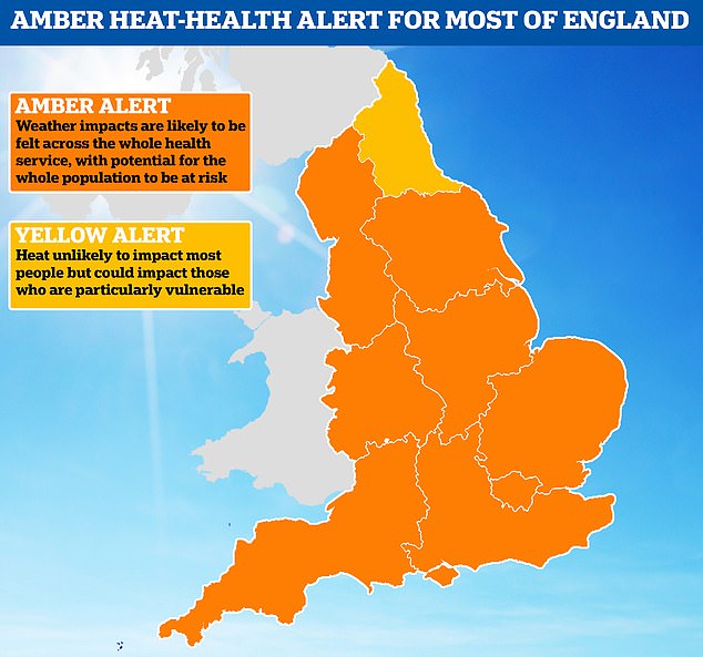
The UK Health Security Agency has an amber heat health alert until Sunday night in place for all regions of England apart from the North East, which has a yellow alert.
Climate and health experts told MailOnline the UK should brace for another wave of excess deaths similar to the 3,000 recorded during last year’s sizzling summer.
Hundreds of Britons could die this week – with the over 65s, newborn babies and people with health conditions such as heart or lung issues said to be most at risk.
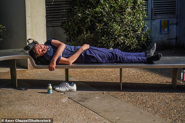


A man sleeps on a bench in London in the bright sunshine today as the heatwave continues


A woman cools off in front of a large fan at a London Underground station in the heat today
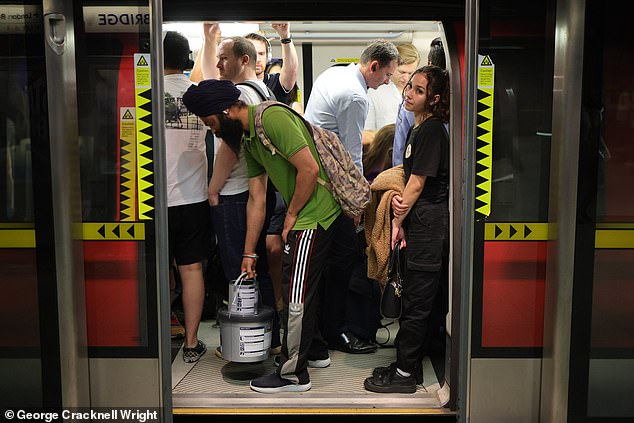


Commuters pack on to a hot Jubilee line Underground train at London Bridge station today
The Met Office said the hot weather in the southern part of Britain looks set to continue for the rest of the week.
With today starting off warm and humid – with some fog in the east – the Met Office said temperatures across the UK will rise under largely sunny skies as the day continues.
Temperatures in the South look will likely exceed 30C in many areas, with London gearing up to hit a high of 32C at around 4pm this afternoon.
The west of the country may see some isolated heavy or thundery showers later on, but the hot weather looks set to continue into the weekend.
Met Office chief forecaster Paul Gundersen said: ‘High pressure is situated to the southeast of the UK, which is bringing more settled conditions and temperatures well above average for the time of year.
‘While the highest temperatures are expected in the south, heatwave conditions are likely across much of England and Wales especially, with parts of Scotland and Northern Ireland also likely to see some unseasonably high temperatures.’
September’s heatwave is likely to peak on Saturday with temperatures rising as high as 33C (91F) in London, the Met Office has said, although further north will be cooler.
The UK Health Security Agency heat health alert means weather impacts are likely to be felt across the health service, with those aged above 65 or those with pre-existing respiratory or cardiovascular disease at greater risk.
Although temperatures have risen this high before in September, it is unusual for the heat to last so long.
Parts of the South are also thought to have endured a tropical night overnight, which is defined as having temperatures over 20C (68F).
The record highest overnight minimum temperature for September in the UK is 21.7C (71.1F).
The temperature last night in the Mumbles in South Wales fell to 21C (69.8F) – meaning it was not quite a record breaker. But the record could again be challenged tonight.
Stephen Dixon of the Met Office said: ‘On four occasions in Met Office climate statistics has September had three consecutive days of temperatures above 30C.
‘Including (Wednesday), we’re up to three on this event and expect to exceed 30C (on Thursday). This would be the most consecutive days of temperatures above 30C in September.’
Clear and settled conditions have also given rise to glowing sunsets and hazy dawns as dust from the Sahara is blowing north in the atmosphere.


A surfer makes the most of the warm weather in the water off Polzeath in Cornwall today


Vanessa McIntyre, 25, and Maddie Sykes, 26, from Australia, cool off at Brighton today
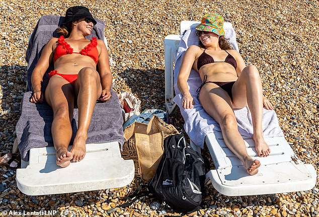


Sunbathers make the most of the heatwave on Brighton beach in East Sussex today






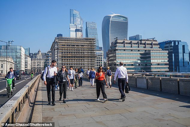


Pedestrians walk across London Bridge in the capital today amid the very hot weather


Joggers go for a morning run at Primrose Hill in North London today shortly after sunrise


People enjoy the hot weather underneath the Knaresborough Viaduct in North Yorkshire today
The plume was captured on satellite imagery moving across the Mediterranean and stretching for more than 1,200 miles on its way to the UK and Scandinavia.
It is contributing to worsening air pollution this week, with hot, still weather known to also increase ground levels of harmful ozone.
Mr Dixon said: ‘Saharan dust is one factor in the air quality forecast.
‘Moderate levels of air pollution are expected across the UK on Saturday, with some high levels also likely for central and eastern parts.
‘Air pollution levels will look to reduce from Sunday, as we start to transition to this more unsettled picture from the north west.’
Dust brings red skies because particles in the atmosphere scatter blue light more than red, which is why the sky appears blue during the day.
When the sun is low in the sky, like at dawn and dusk, the light has farther to travel and so the blue light is scattered too much for us to see it, with the Saharan dust exacerbating this effect and turning the skies a deeper red.
The folklore expression ‘red sky at night, shepherd’s delight’ is true in many cases, the Met Office has said, as it means high pressure and fair weather is moving in from the west, ‘whereas red sky in the morning, shepherd’s warning’ – means that high pressure is beginning to move away.
Mr Dixon said: ‘Saharan dust in the atmosphere is generally decreasing in concentration in the coming days and the remnants of that air is expected to push away as the UK returns to a more mobile Atlantic weather pattern from early next week.’
The heatwave is being driven by tropical storms pushing a high pressure system over the UK, with the jet stream having moved to the north and bending into what is known as an omega blocking pattern.
Named after the Greek letter omega because of its shape, this system occurs when an area of high pressure gets stuck between two areas of low-pressure to the west and east and also slightly south.


A man walks across Millennium Bridge in London today amid the very hot weather


A surfer makes the most of the warm weather in the water off Polzeath in Cornwall today


Rowers travel along the River Thames near Maidenhead in Berkshire this morning
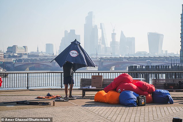


A man adjusts a parasol on the Southbank of the River Thames in London this morning
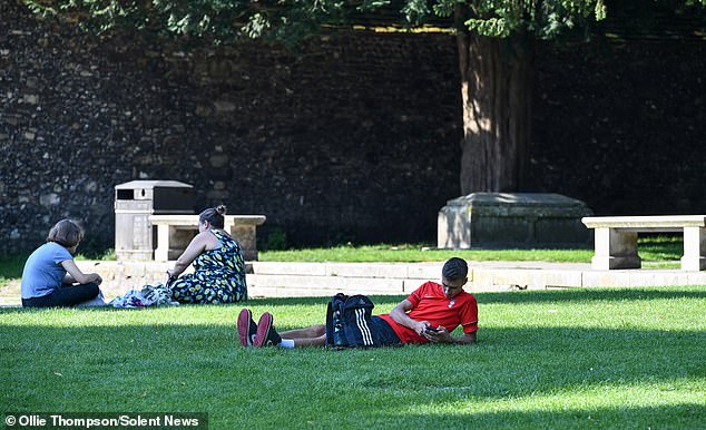


Pictured People relax in the shade of Winchester Cathedral in Hampshire this morning


Pedestrians walk across London Bridge in the capital today amid the very hot weather
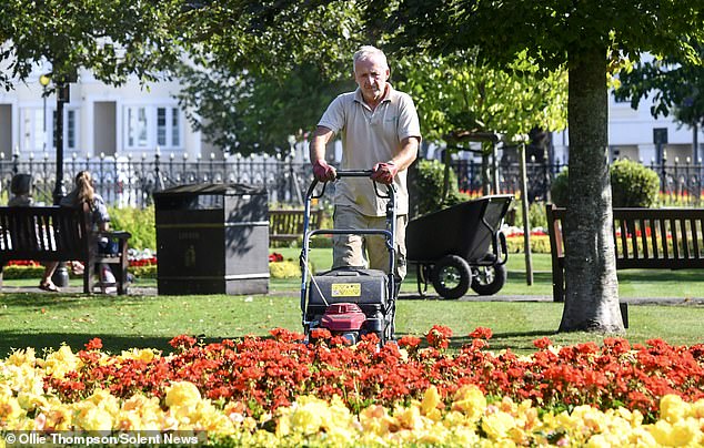


Landscaper Andrew Thompson mows the grass at the Abbey Gardens in Winchester today


Joggers run across Millennium Bridge in London today amid the very hot weather
This has brought torrential rain and flooding for Spain and Greece but hot, dry and clear conditions for the UK and central Europe.
Met Office chief meteorologist Neil Armstrong said: ‘An active tropical cyclone season in the North Atlantic has helped to amplify the pattern across the North Atlantic, pushing the jet stream well to the north of the UK, allowing some very warm air to be drawn north.
‘It’s a marked contrast to the much of meteorological summer, when the UK was on the northern side of the jet stream with cooler air and more unsettled weather.’
The Met Office defines a heatwave as three consecutive days of a particular region exceeding a given threshold, which varies around the UK.
For Scotland, Wales, Northern Ireland, Cornwall and northern England, the threshold is 25C (77); for Somerset, Hampshire and the Welsh Borders, 26C (79F); the south coast, East Anglia and the East Midlands, 27C (81F); and for London and the home counties the threshold is 28C (82F).
Yesterday was the warmest September day since September 13, 2016, when 34.3C (97.7F) was recorded at Gravesend in Kent.
The temperature set that day in 2016 was the warmest of the year – the only time this century a particular year’s hottest day has been in September.
Before then, you have to go back to 1954 when the warmest day of the year was September 1, which reached 29.4C (84.9F) at Mildenhall, Suffolk.
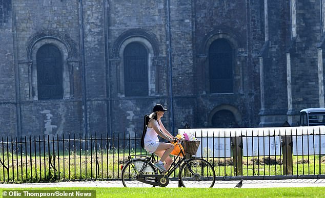


A cyclist enjoys a warm morning ride in the grounds of Winchester Cathedral today
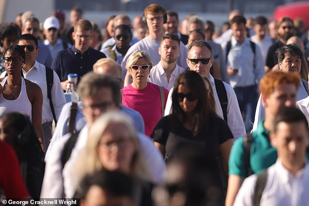


Commuters cross London Bridge this morning amid hot and sunny weather in the capital
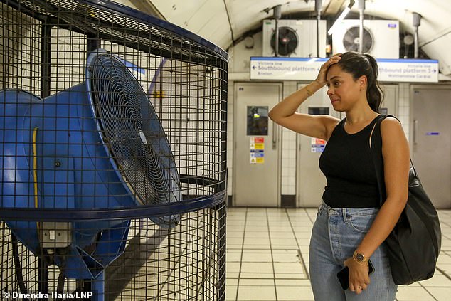


A woman cools off in front of a large fan at a London Underground station in the heat today
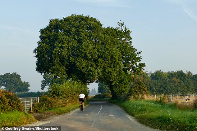


People go out exercising early in the cool morning’s air at Dunsden in Oxfordshire today
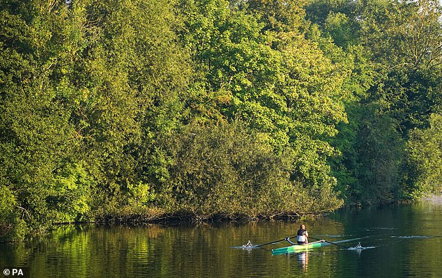


Rowers travel along the River Thames near Maidenhead in Berkshire this morning


Commuters pack on to a hot Jubilee line Underground train at London Bridge station today
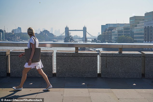


Pedestrians walking on London Bridge look across to Tower Bridge in the sunshine today
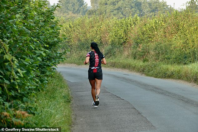


People go out exercising early in the cool morning’s air at Dunsden in Oxfordshire today
Prior to that it was September 5, 1949, that year’s joint warmest day when it reached 32.2C (89.96F) at Shoeburyness in Essex, Cromer in Norfolk and Mildenhall in Suffolk.
Met Office spokeswoman Ellie Glaisyer revealed no change to the weather is imminent.
She said: ‘We’re continuing with the southerly airflow coming from the continent, with high pressure dominating.’
Ms Glaisyer said the only exceptions to the warm sunshine are areas affected by low cloud overnight and through the mornings, which yesterday hit parts of the Midlands, before burning back by the afternoon, and western regions where showers could occur.
She said: ‘That low cloud could push back inland again overnight but it should burn back to the coast during today. The same thing could happen overnight into Friday morning.’
Ms Glaisyer added showers – possibly including thunder – could affect South West England, western Wales, parts of Scotland and Northern Ireland over the coming days but that elsewhere is due to be ‘fine, sunny and very warm’.
Smart thermostat firm tado° has made an interactive map showing how hot your home gets in a heatwave. It is based on indoor temperatures recorded during the last heatwave on June 25


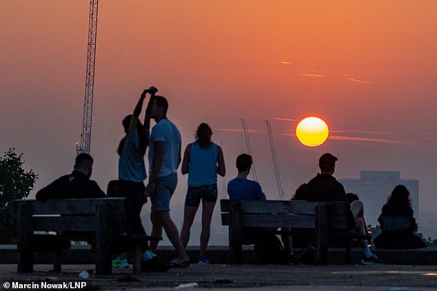


Visitors to Primrose Hill in North London enjoy a hazy sunrise today before temperatures soar
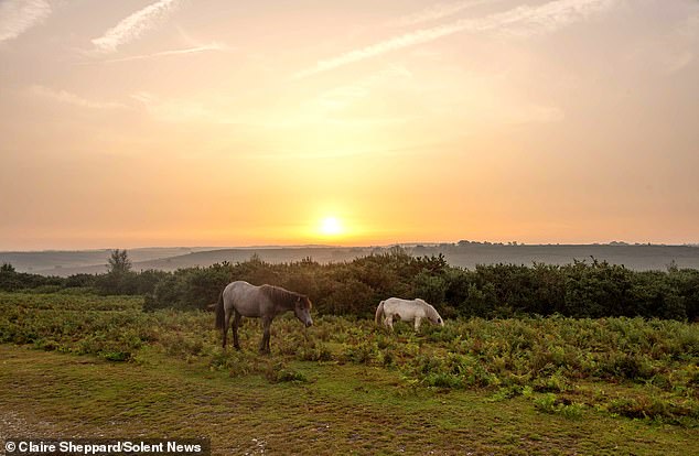


Sunrise over Godshill in the New Forest in Hampshire this morning as ponies graze


A person watches the sunrise at Primrose Hill in North London this morning
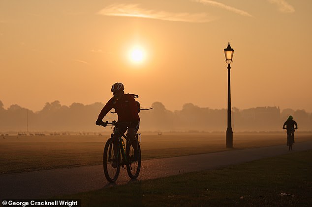


A cyclist rides through Blackheath Common in South East London this morning
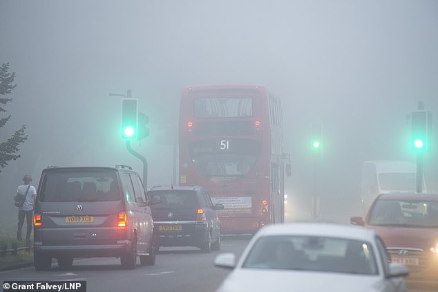


A foggy start to the day in Bromley, South East London, before temperatures soar later today
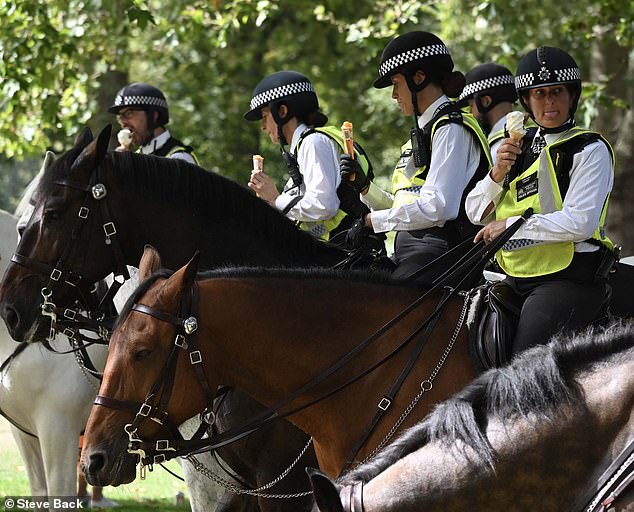


Mounted police officers enjoyed ice cream in the heat at St James’s Park in London yesterday
The weather is not set to change until early next week, at least, when a weather front attempts to make inroads.
The Met Office said: ‘Temperatures behind the front are likely to return to near-normal values, but some eastern and south-eastern regions may retain the warm and predominantly dry conditions.’
Even for the rest of the month, plenty more fine and dry weather is forecast.
In the longer-range forecast for the second half of the month, the Met Office predicts ‘drier conditions than average’, although ‘spells of rain and showers are still possible’.
It added: ‘There are indications that late September may see a higher probability of high pressure than is typical for the time of year.
‘It is likely that temperatures will generally be above average for the time of year, with a higher likelihood of some unseasonably warm spells than would normally be expected.’
Source: | This article originally belongs to Dailymail.co.uk
