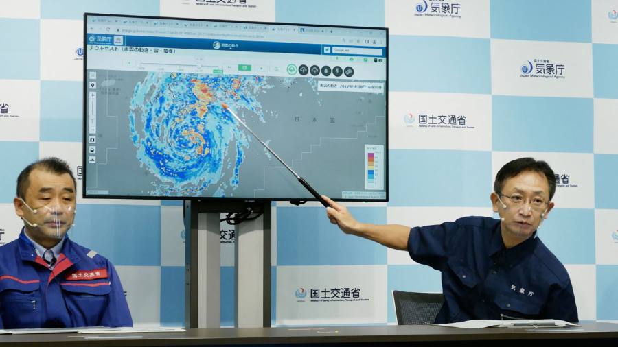
Japan’s southern island of Kyushu has been hit by a typhoon that brought powerful winds and torrential rain, prompting authorities to recommend the evacuation of millions of people from their homes.
Typhoon Nanmadol made landfall near the city of Kagoshima on Sunday. Large parts of the island spent the day under the government’s highest level of warning. Gusts of 100mph damaged buildings and plunged more than 200,000 households into an electricity blackout on the island.
The typhoon’s arrival was preceded by huge waves and some of the strongest winds ever recorded in that region. Some parts of Miyazaki prefecture, on the eastern side of Kyushu, were slammed with 400mm of rain in the 24 hour period between Saturday and Sunday afternoons.
Ahead of making landfall earlier on Sunday, residents of Kagoshima and the surrounding prefecture were warned to seek shelter in the sturdiest buildings available, and if possible, take refuge on higher floors.
Prime Minister Fumio Kishida concluded a meeting with senior officials overseeing the typhoon response with a statement that the Japanese public should evacuate to safety “at the slightest feeling of danger”.
The Japanese state broadcaster, NHK, said local authorities are issuing evacuation orders for millions of people.
The evacuation warnings currently in place are non-mandatory — a status that, in the past, has meant that large numbers of people remain in their homes beyond the point where they can easily move to a shelter.
Japanese media reports said tens of thousands of people had already moved to evacuation centres as electricity was cut, while mobile phone networks battled to remain operational.
NHK reported around a dozen injuries related to the floods and winds.
By midnight on Sunday, the Japan Meteorological Agency had placed Miyazaki prefecture and most of Kyushu’s eastern coast under a special warning for extreme rainfall. It is rare for the agency to take such a step for one of the country’s four main landmasses.
The typhoon, which may rank as one of the strongest to make landfall on one of Japan’s main islands, is moving north along a path expected to encounter significant residential and industrial hubs. It is forecast to bring further rainfall, raising the threat of floods and landslides.
The expected trajectory mapped by the JMA shows the typhoon heading toward the southwestern region of Japan’s main Honshu island on Monday and continuing north-east on Tuesday. Japan’s capital, Tokyo, is not currently near the centre of the typhoon’s expected path.
The rains, winds and thunderstorms have already caused significant disruption to rail, ferry and air traffic services, and are expected to prompt widespread cancellations on Monday.

