North Carolina’s bald cypress forests, with their distinctive reddish bark and unique “knees,” have long been a defining feature of the region.
However, these wetlands are rapidly transforming into eerie “ghost forests,” marked by pale, leafless tree remnants that dot the landscape. Research shows that this change, visible from space, correlates with rising sea levels, hurricane damage, and shifting marshlands.
Iconic Bald Cypress Ecosystems of North Carolina
Eastern North Carolina’s bald cypress forests are among the most iconic coastal ecosystems in the southeastern U.S. Known for their reddish-brown bark, green needle-like leaves, and clusters of knobby “knees” that emerge around their trunks, these impressive trees thrive in freshwater swamps and can grow over 100 feet (30 meters) tall. Some bald cypress trees can live for thousands of years, making them some of the oldest living trees in the eastern United States.
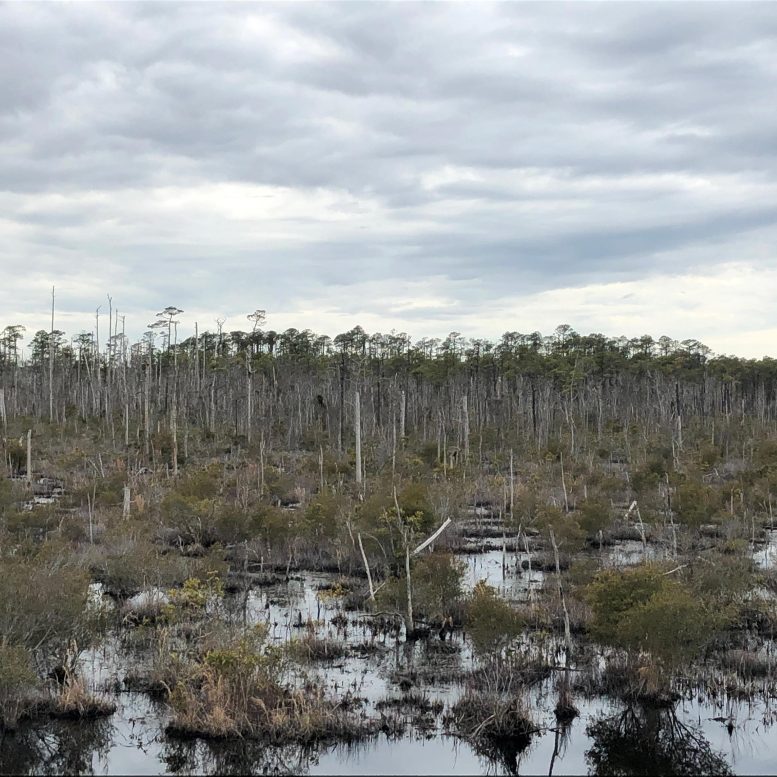
Recently, however, North Carolina’s bald cypress and other coastal forests have taken on a ghostly appearance. In many areas, once-healthy green cypress and pine trees have died, shedding their bark and transforming into pale, leafless snags that line the waterways like gravestones. Before winds topple these snags and shrubs overgrow them, researchers refer to these eerie landscapes as “ghost forests.”
Visualizing Changes in Albemarle-Pamlico Peninsula
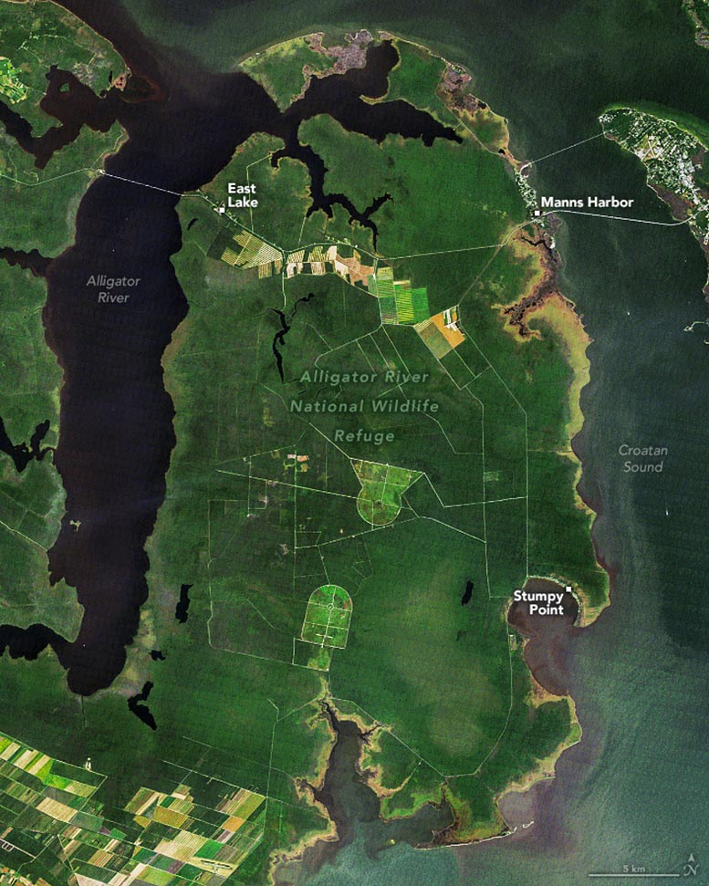
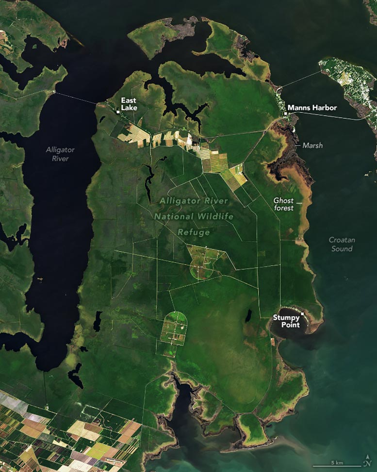
This pair of satellite images taken from 2005 to 2024 highlight this transformation on North Carolina’s Albemarle-Pamlico Peninsula, where marshes, ghost forests, and shrubs now cover large areas, including parts of the Alligator River National Wildlife Refuge. The images were captured by the Thematic Mapper (TM) on Landsat 5 in 1985 and by the Operational Land Imager-2 (OLI-2) on Landsat 9 in 2024.
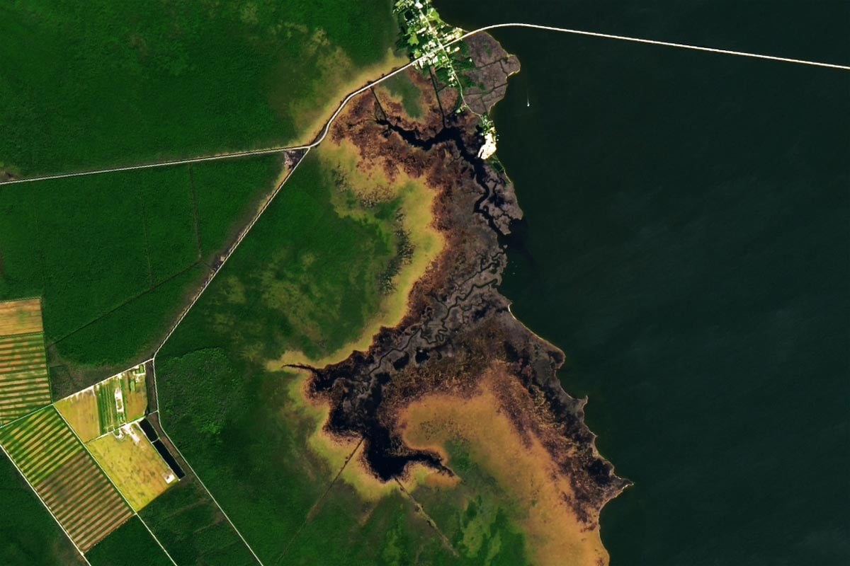
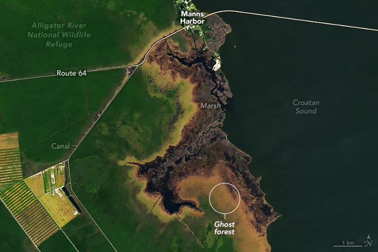
Ghost forests appear light brown and marshes dark brown. Healthy forests are green. After ghost forests appear, shrubs (light shades of green and brown) typically replace them. Evergreen shrub bogs called pocosins, as well as various types of deciduous shrubs, are found in this area.
Note that some of the browning may relate to differences in the timing of seasonal changes in the deciduous vegetation. Bald cypress are among the deciduous tree species that develop colorful foliage in the fall. Other deciduous vegetation found in this area includes oaks, red maple, sweetgum, and marsh grasses. The image below shows a more detailed view of marshes, ghost forests, and shrublands around Manns Harbor.
Rapid Expansion of Ghost Forests in Recent Decades
Ghost forests have expanded rapidly in North Carolina in recent decades. Scientists from Duke University and the University of Virginia analyzed Landsat satellite images collected between 1985 and 2019 and found that roughly 11 percent of forested land in the refuge became ghost forest over that period.
The researchers know that droughts, hurricanes, the presence of drainage canals, and sea level rise all contribute to the expansion of ghost forests, but they’re still untangling the relative importance of each factor. Sea level along this part of North Carolina is rising by about 3-4 millimeters per year, about three times faster than the global average.
Case Study: 2011 Die-Off Event
However, the death of forests in the Alligator River Wildlife Refuge hasn’t tracked exactly with the rate of sea level rise. Instead, these forests saw a particularly large die-off in 2011 following a severe drought and a direct hit by Hurricane Irene. The drought reduced the flow of rivers and allowed saltwater to flow upstream and through irrigation canals, killing trees in the process. In the image above, notice how ghost forests line the northern edge of canals along U.S. Route 64 and U.S. Route 264. The hurricane, which hit the state in August 2011, swamped coastal areas with salty floodwaters and salt spray for several kilometers inland.
The Role of Sea Level Proximity
“The closer a forest is to sea level, the greater the risk of tree death and the detection of ghost forests,” said University of Virginia environmental scientist Xi Yang. Yang came to that conclusion during an ongoing NASA-sponsored aerial mapping project called THELORACS (Tree Health Evaluated using LiDAR, Optical, and Radar Applications across Coastal Systems), which uses aircraft to collect high-resolution imagery of millions of trees in ghost forests throughout the eastern seaboard.
“You can also see the effects of climate change collide with human development in Landsat images like this,” said Duke University ecologist Emily Bernhardt. “Marshes shift locations over time as sea levels rise, but there’s nowhere for cypress forests to go. They’re already hemmed in by farmland or other development, so these iconic wetlands are getting squeezed and dying off in mass mortality events instead.”
NASA Earth Observatory images by Michala Garrison, using Landsat data from the U.S. Geological Survey. Ghost forest photograph courtesy of Emily Bernhardt (Duke University).