
Recent research indicates that the fastest-growing fires, responsible for the majority of fire damages in the last two decades, are accelerating in the Western U.S.
This study emphasizes the need for national fire risk assessments to consider fire speed to better prepare and protect communities through enhanced building codes and evacuation plans.
Emerging Threats From Fast-Growing Fires
A new study from the University of Colorado Boulder reveals that fast-growing fires, while relatively rare, were responsible for nearly 90 percent of fire-related damages in the U.S. between 2001 and 2020. These “fast fires” propel embers ahead of rapidly advancing flames, igniting homes before emergency responders can intervene. Published in Science, the research shows that these fires are accelerating, particularly in the Western U.S., putting millions of people at greater risk.
The study also exposes a major gap in fire preparedness: current national fire risk assessments fail to consider fire speed, leaving communities without the information needed to prepare for rapidly spreading fires.
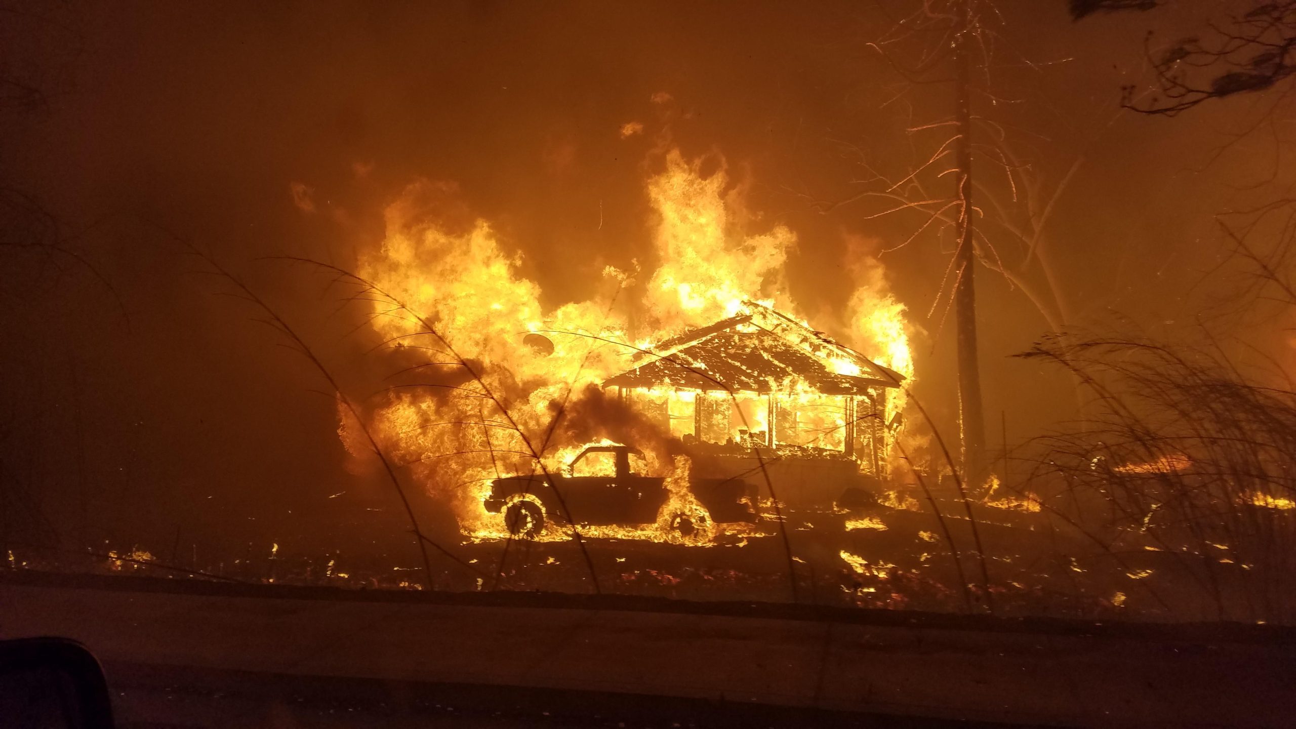
The Underrated Danger of Fire Speed
“We hear a lot about megafires because of their size, but if we want to protect our homes and communities, we really need to appreciate and prepare for how fast fires move,” said Jennifer Balch, CIRES fellow, associate professor of Geography, and the lead author of the study. “Speed matters more for keeping people safe.”
Balch and her colleagues were inspired to look closer at fire speed after the Marshall Fire, which destroyed more than 1,000 homes in Boulder County, Colorado, in December 2021. The fire burned less than 6,100 acres (24.7 square kilometers) but grew quickly due to a combination of dry conditions and high winds. Less than an hour after the fire was reported, it had spread to a town 3 miles (4.8 kilometers) away, eventually prompting the evacuation of tens of thousands of people. In the aftermath, Balch’s team was eager to understand how fire growth rates impact fire risk across the country.
Advanced Techniques in Fire Growth Analysis
The researchers used satellite data to analyze the growth rates of over 60,000 fires in the contiguous U.S. from 2001-2020. Using a cutting-edge algorithm, which involves applying a set of calculations to each satellite pixel, they identified and recorded the perimeter of each fire for each day it was active.
“Until now, we had scattered information about fire speed,” said Virginia Iglesias, interim director of Earth Lab and co-author of the study. “We harnessed Earth observations and remote sensing data to learn about fire growth across the nation in a systematic manner.”
Alarming Trends and Protective Strategies
The team used the fire perimeter maps to calculate the growth rate of each fire as it progressed. They then zoomed in on the fastest fires, which grew more than 4,003 acres (16.2 square kilometers) in a single day, and probed how the highest growth rates changed over time. The analysis revealed a staggering 250 percent increase in the average maximum growth rate of the fastest fires over the last two decades in the Western U.S.
“Fires have gotten faster in the western U.S. in just a couple of decades,” Balch said. “We need to focus on what we can do to prepare communities: hardening homes and making robust evacuation plans.”
To evaluate the impacts of fast fires on people and infrastructure, the researchers compared the growth rates of the fastest fires to information recorded in incident reports about the number of structures damaged or destroyed per fire event. They found that fast fires accounted for 88 percent of the homes destroyed between 2001 and 2020 despite only representing 2.7 percent of fires in the record. Fires that damaged or destroyed more than 100 structures exhibited peak fire growth rates of more than 21,000 acres (85 square kilometers) in a single day.
“These results change how we think about wildfire risk because they position growth rate as a key determinant of a fire’s destructive potential,” Iglesias said.
Critical Gaps in Fire Risk Models
The work also highlights a critical risk assessment gap. At the national level, wildfire risk models include parameters for area burned, intensity, severity, and probability of occurrence, but they do not incorporate growth rate or other measures of fire speed. Government agencies and insurance companies that use these models are therefore missing vital information about how fires spread, which homeowners could use to better protect themselves and their communities. The authors believe this needs to change.
“When it comes to safeguarding infrastructure and orchestrating efficient evacuations, the speed of a fire’s growth is arguably more critical than its sheer size,” Iglesias said.
For more on this research, see Tracking the Alarming Acceleration of Wildfire Speeds.
Reference: “The fastest-growing and most destructive fires in the US (2001 to 2020)” by Jennifer K. Balch, Virginia Iglesias, Adam L. Mahood, Maxwell C. Cook, Cibele Amaral, Amy DeCastro, Stefan Leyk, Tyler L. McIntosh, R. Chelsea Nagy, Lise St. Denis, Ty Tuff, Erick Verleye, A. Park Williams and Crystal A. Kolden, 24 October 2024, Science.
DOI: 10.1126/science.adk5737